Routes, Maps & Inspiration for Self Guided Walking & Hiking in Spain's Sierra Nevada
N.B This is an interactive map that opens up in new window
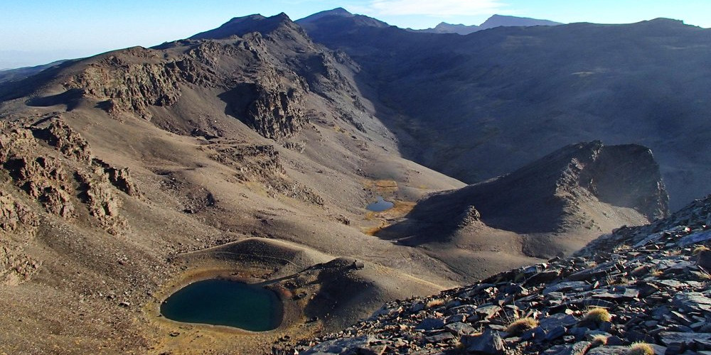
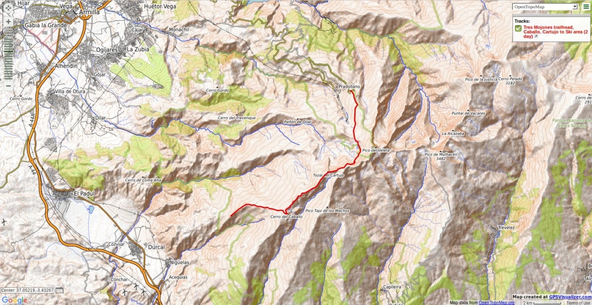
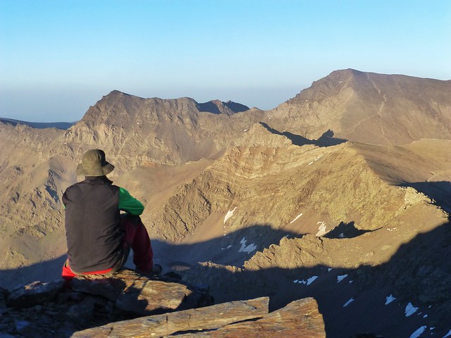
High trailhead, gentle ascent to Cerro de Caballo via the ridge of Tres Mojones. Pleasant ridge on faint tracks to to Tajos Altos and onto Pico del Cartujo. Continue on the ridge with small steps until the track to the Refugio Elorrieta is met. Drop down via the small lakes of Lagunillas and hence to the Hoya de la Mora.
Major peaks covered: Cerro de Caballo 3005m, Tajos Altos 2985m, Pico del Cartujo 3152m
Seasonal notes: Generally easy winter walking in good snow conditions. The mountain flank to the Elorietta may not be possible under snow as it is an avalanche blackspot.
Options: Instead of the high ridge we can take the slightly easier Verada Cortado at a lower level. This traverses impressive rock scenery and beautiful lakeside camping locations.
N.B Please take note of National Park Rules and Regulations regarding Wild Camping
Recommended map: Parque Nacional de Sierra Nevada 1:40000 www.penebetica.com

Want some help? Find a guide? CONTACT US
KNOWLEDGE BASE
Mountain database, refuges, altitude sickness, avalanche dangers, equipment lists, gear rental, FAQs etc
Contact us via our Contact Page Spanish Highs Tours Ltd Head Office:
41 Axholme Drive,
Epworth,
DN91EL,
North Lincolnshire,
UK.
Registered Office: 20-22 Wenlock Road, London, N1 7GU, England © 2019 sierranevada.guide
info@spanishhighs.co.uk
Company Number 09960909 Registered in England & Wales