Routes, Maps & Inspiration for Self Guided Walking & Hiking in Spain's Sierra Nevada
N.B This is an interactive map that opens up in new window
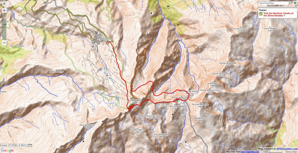
If you make use of the summer bus (or ski lift) uplift to Los Posiciones de Veleta, then there is easy access to the start of this amazing route. Drop into the deep corrie of the Coral de Veleta via the narrow Veredon Superior path. Cross the valley floor on the remains of old moraines to the centre of the corrie.
Descend NE down a lateral moraine into an area of rushing waters and greenery. Cross the valley to the right on a faint track before starting up the zig zags that lead steeply up to the col before the peak of Veta Grande. This is a superb situation. The way ahead alongside the northern flanks of the Sierra Nevada ridge is seen from here, as are the Lagunas of Gabata and Laguna Larga.
The paths onwards are narrow and steep sided but hands are not necessary although a good head for heights might be. Another hour and the lakes are reached. A great place to wild camp if desired.
The narrow path continues crossing over the ridges of the Espolon de Puntal de la Caldera and arriving at a scrappy scree slope that must be ascended to reach the col near Juego de Bolos. Then onto the Collado de Ciervo before returning on the old road to the Collado de Carihuela and a return to the start point.
Wild camping suggestions - Laguna Larga, Laguna Gabata
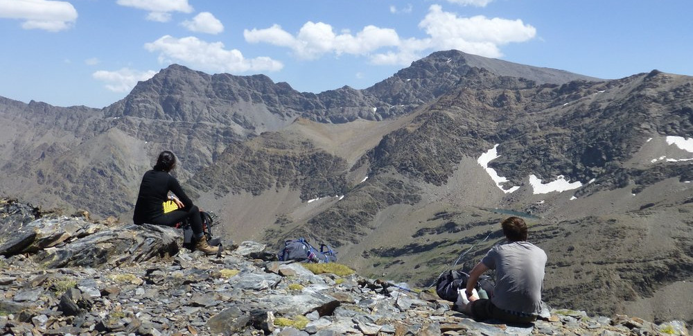
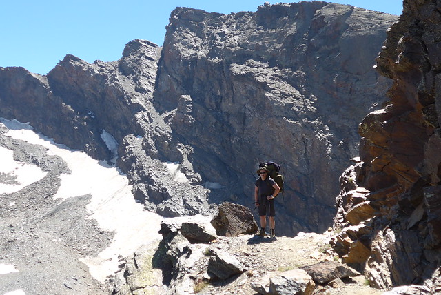
Options - easy to extend this trip by taking in peaks along the way. The photos below show a 3 day trip outlined by this route in which we did many peaks adjacent to the route. A delightful trek!
N.B Please take note of National Park Rules and Regulations regarding Wild Camping
Recommended map: Parque Nacional de Sierra Nevada 1:40000 www.penebetica.com

Want some help? Find a guide? CONTACT US
KNOWLEDGE BASE
Mountain database, refuges, altitude sickness, avalanche dangers, equipment lists, gear rental, FAQs etc
Contact us via our Contact Page Spanish Highs Tours Ltd Head Office:
41 Axholme Drive,
Epworth,
DN91EL,
North Lincolnshire,
UK.
Registered Office: 20-22 Wenlock Road, London, N1 7GU, England © 2019 sierranevada.guide
info@spanishhighs.co.uk
Company Number 09960909 Registered in England & Wales