White Villages of the Poqueira
Alpujarras
Grade: Challenging
Distance: 10 km
Ascent: 544 m
Time: 5 hrs
Optimal months: Mid-Sep to Mid-Jun
Map🗺️ - 3D⛰️ - Guide🔗 - Photos 📷
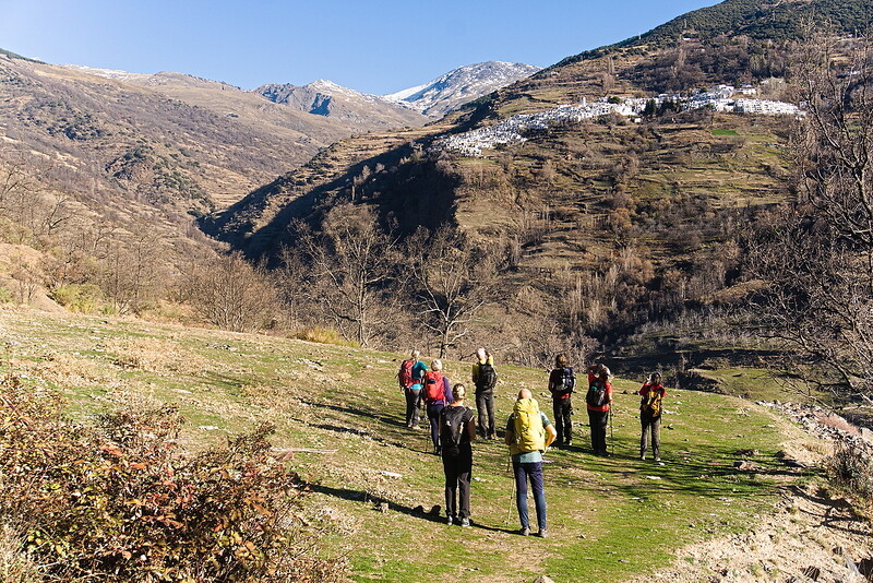
The three white hill villages of Capileira, Bubion and Pampaneira sit on hillsides above the dramatic Poqueira gorge. Mulhacen, at 3482m rises above the towns. This walk links all three of these villages and crosses the gorge twice.
A start is made from the highest of the villages, Capileira. The trail drops down to cross the Rio Poqueira via a small bridge. Then its an undulating traverse on the west side of the river before dropping down, recrossing the river and climbing up to the village of Capileira. After a brief stop (maybe to visit a bodega!), we head steeply uphill through the village, exiting at the top before continuing the journey to Bubion. From Bubion it is then another 30 mins to reach the end at Capileira.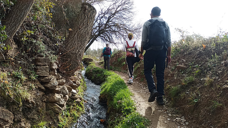
Ancient Waterways and Gorges of Lanjaron
Alpujarras
Grade: Challenging
Distance: 12 km
Ascent: 621 m
Time: 6 hrs
Optimal months: Mid-Sep to Mid-Jun
Map🗺️ - 3D⛰️ - Guide🔗 - Photos 📷
No need for transport today! The walk starts and ends from your hotel. It is very varied circular walk that has proved to be very popular with clients. We first visit the Arab Castle and walk along the cliff tops of the Tajos de Colorao opposite.
A short climb and we reach the Ermita of the Tajos de la Crux. This is a magniificent mirador which overlooks the town. We traverse land northwards and reach the Camino de las Sierras, an old drove trail to the mountains. This will follow until we can take a faint track which traverse down to cross the Rio Lanjaron by an old bridge. A superb section follows consisting of a series of beautiful irrigation channels and chestnut woods before we drop steeply back down to the hotel in Lanjaron.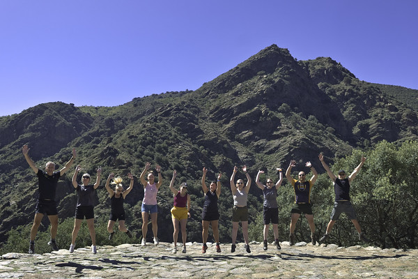
The Medieval Way - Taha del Pitres Villages
Alpujarras
Grade: Moderate
Distance: 9 km
Ascent: 424 m
Time: 5 hrs
Optimal months: Mid-Sep to Mid-Jun
Map🗺️ - 3D⛰️ - Guide🔗 - Photos 📷
A lovely drive through the Alpujarras brings us to the Taha de Pitres region. This is an area characterised by small white villages, steep sided gorges and abundant flora and fauna.
Most of this walk we are follow old medieval trails through the hills and villages. We start in Mecina Fondales and drop down to the enchanting village of Fondales. Here we turn east and head for Ferrierola, perched high above the Trevelez gorge. Then it's uphill to visit the very quaint, Atalbeitar before rising to reach the road that leads us to the town of Portugos. We take quiet back tracks to Pitres before dropping steeply back down to the start point at Mecina.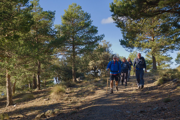
GR240 High Forests of the Alpujarras
Alpujarras
Grade: Moderate
Distance: 11 km
Ascent: 207 m
Time: 5 hrs
Optimal months: Mid-Sep to Mid-Jun
Map🗺️ - 3D⛰️ - Guide🔗 - Photos 📷
We drop you off at the Forest Station at Hoya del Portillo. Then it's up through the pine forests to break out onto open hillside and arrive at the Puerta del Molina. This is a superb viewpoint of the Sierra Nevada and all the main peaks cam be seen.
We drop back down on a dirt track before joining up with the long distance path, the Sulayr,GR240. We drop down through gorgeous forested hillsides and all the way back for a cold celebration cold drink in the village of Capileira. A totally enjoyable, different and engaging day!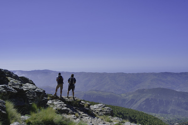
Rio Bermejo
Alpujarras
Grade: Moderate
Distance: 9 km
Ascent: 529 m
Time: 4 hrs
Optimal months: Mid-Sep to Mid-Jun
Map🗺️ - 3D⛰️ - Guide🔗 - Photos 📷
The Río Bermejo circular walk, starting from Pitres in the Alpujarras region of Spain, is a scenic trail that offers hikers a chance to experience the natural beauty and cultural heritage of the area.
The trail takes you through varied terrains, including lush river valleys, traditional irrigation channels (acequias), and picturesque white-washed villages that are characteristic of the Alpujarras. The route offers stunning views of the surrounding mountains and valleys, with the Río Bermejo itself being a notable feature, especially during seasons when the water flow is robust.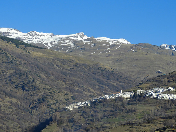
Acequias del Poqueira
Alpujarras
Grade: Moderate
Distance: 12 km
Ascent: 220 m
Time: 4 hrs
Optimal months: Jan to Dec incl
Map🗺️ - 3D⛰️ - Guide🔗 - Photos 📷
Walking the acequias of the Poqueira Gorge is one of the most beautiful and peaceful hiking experiences in the Alpujarras region of the Sierra Nevada, combining ancient Moorish water engineering, dramatic scenery, and traditional whitewashed villages.
These acequias (irrigation channels) follow gentle gradients along the gorge and hillsides, offering shady, lush paths with panoramic views. Many of them date back to Islamic times and are still in use today, watering the terraced fields of Capileira, Bubión, and Pampaneira.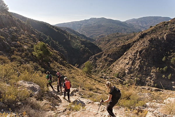
Ruta Pescados, Lanjaron
Alpujarras
Grade: Moderate
Distance: 11 km
Ascent: 387 m
Time: 4 hrs
Optimal months: Mid-Sep to Mid-Jun
This is a relatively new route that celebrates the route that fishermen from the coast used to take to deliver their fish to the mountain villages.
We leave our hotel and follow a well marked path to a viewpoint over the town and surrounding mountains. Then we descend towards the Rules Dam following green streams and valleys. Climbing up to another viewpoint we meet a swing chair installed by the town hall. A short stretch of road walking follows before we drop down steeply into the lush Rio Lanjaron valley, below towering cliffs. The steep climb back up to the castle in town isn't as bad as it looks as the trail is well graded.