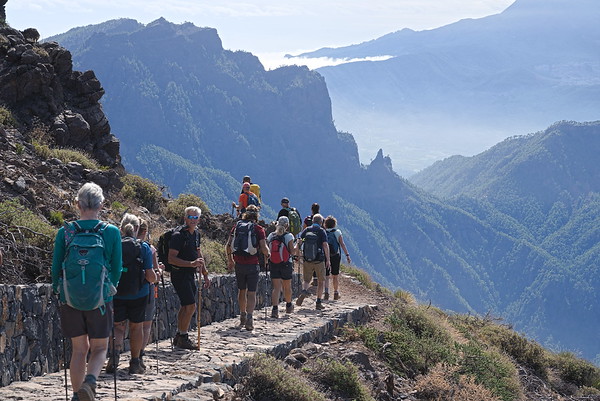
Rim of the Caldera de Taburiente
La Palma
Grade: Moderate
Distance: 13 km
Ascent: 456 m
Time: 6 hrs
Optimal months: Mid-Sep to Mid-Jun
To get to the starting point of this spectacular walk you'll be taken up by private bus from sea level and through all five different vegetation levels, to the highest peak of the island (Roque de Los Muchachos). From here we first walk over a viewing point and later along the highest rim of the Island.
After visiting the superb viewing platform of the Espigon del Roque (2382m), we shall cover the peaks of Roque de los Muchachos (2426m), Pico de la Cruz (2351m), Piedra Llana (2314m) and Pico de la Nieve (2232m) before dropping down to a meeting point with the bus. This whole rim of the Caldera gives relatively easy walking on good, but sometimes rough paths with always spectacular views on the right hand side down into the crater. This is a superb first day walk which will help orientate you to the island. It will give us a birdsview over La Palma all the way over to the neighbouring islands of Tenerife, La Gomera and El Hierro. The National Park of Caldera de Taburiente and it's huge crater will be at our feet.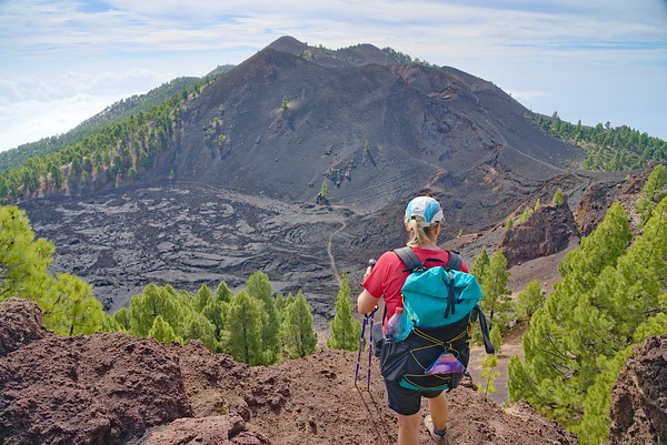
Ruta de los Volcanes
La Palma
Grade: Challenging
Distance: 15 km
Ascent: 797 m
Time: 7 hrs
Optimal months: Mid-Sep to Mid-Jun
In our opinion this walk this is a highlight of the island. It visits lots of extinct volcanoes along the central rim of Cumbre Vieja. Just an incredible days hiking in spectacular scenery that is just so unusual and outside of most peoples experience. A must-do walk!
We start at the visitor center at Area Recreativa El Pilar. From here we skirt Pico Birigoya and rise slowly through the trees until we reach the huge crater at Hoya Negro and Pico Nambroque, which exploded in 1949. Then its onto view the huge lava fields of Maltorada before climbing to the crater and peak of Volcan de la Deseada (1945m). From there a gentle descent past Volcan Cabrito brings us to the crater of Volcan Martin (1529m). We descend through sandy lava fields on good tracks to our waiting transport at the Refugio Fuente de los Roques.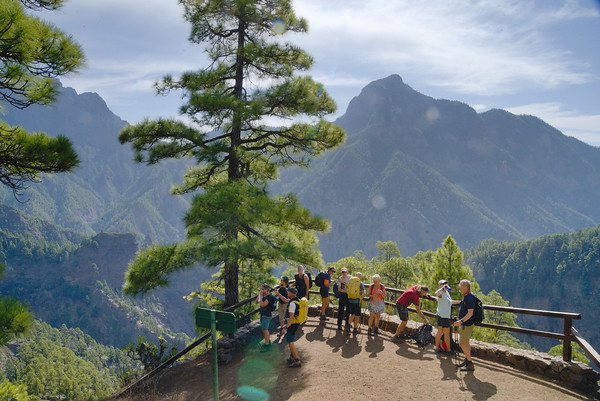
Ruta Agusturias
La Palma
Grade: Moderate
Distance: 14 km
Ascent: 193 m
Time: 5.5 hrs
Optimal months: Mid-Sep to Mid-Jun
Another spectacular transfer takes us to a magnificent viewpoint right into the huge erosion crater of the National Park. The steep windy road zig zags continuously up the gorge to arrive at the Mirador de los Brecitos (1030m).
We leave the bus here and walk down into the very heart of the crater on superb paths surrounded by steep walls. Around and above us rise the peaks along the rim of the Caldera de Taburiente that we visited on our first hike. Truly dramatic scenery! We arrive at the Playa de Taburiente where we can take a lunch break and admire the scenery. Then its down through steep forest tracks to join the river at the Barranco de Angustias. Once down we have the option to visit the waterfall of colours and then we follow the valley downstream through the gorge of Angustias to the finish.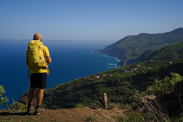
The Wild North and El Tablado Coast
La Palma
Grade: Moderate
Distance: 9 km
Ascent: 362 m
Time: 5 hrs
Optimal months: Mid-Sep to Mid-Jun
Another diverse walk today. A beautiful transfer will show us a big part of the north eastern part of the island. The walk starts in one of Europes last big laurel forests at the Centro de Visitantes La Zarza. We drop down into the rain forests of the Barranco Magdelena where impressive trees and huge ferns accompany us. All of a sudden the view opens up as we rise up out of the Barranco and we are allowed a view over the rugged northern coast of La Palma with its numerous deep canyons.
We drop down to the east of the hamlet of Don Pedro to the Mirador de la Calzada. This is a superb viewpoint over the coast. From here we can see the route ahead. A very steep, rocky but well graded path leads down in a series of zig zags to the valley bottom just above the sea. What follows is a tough ascent but we take it slow and it is on a good path. This brings us to the tiny hamlet of El Tablado, where time seems to have stopped 60 years ago. Maybe we can convince the small bar to open for us? Our bus picks us up just above the village.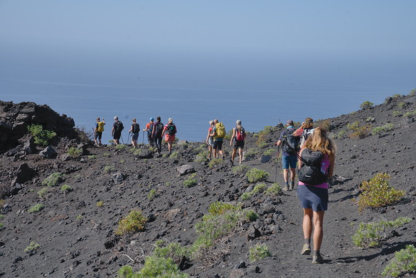
The Southern Volcanoes
La Palma
Grade: Moderate
Distance: 15 km
Ascent: 253 m
Time: 6 hrs
Optimal months: Mid-Sep to Mid-Jun
A short transfer leads to the south west of the island. We start at the Mirador de Charca where we follow the long distance GR130 track through pine forests and alongside vineyards. With constant wonderful views towards the coast we arrive near the village of Fuencaliente, home of the largest winery of the island.
The excitement builds as we start to descend into volcanic territory, walking towards the coast. The good path descends gradually all the way down to the lighthouse. On our the way down we are able to have a look at the crater of the Teneguia volcano (exploded in 1971) and walk its through incredible lava fields that stretch down to the lighthouse. Here, nature is only now starting to get a grip back into the landscape. An experience not to be missed.