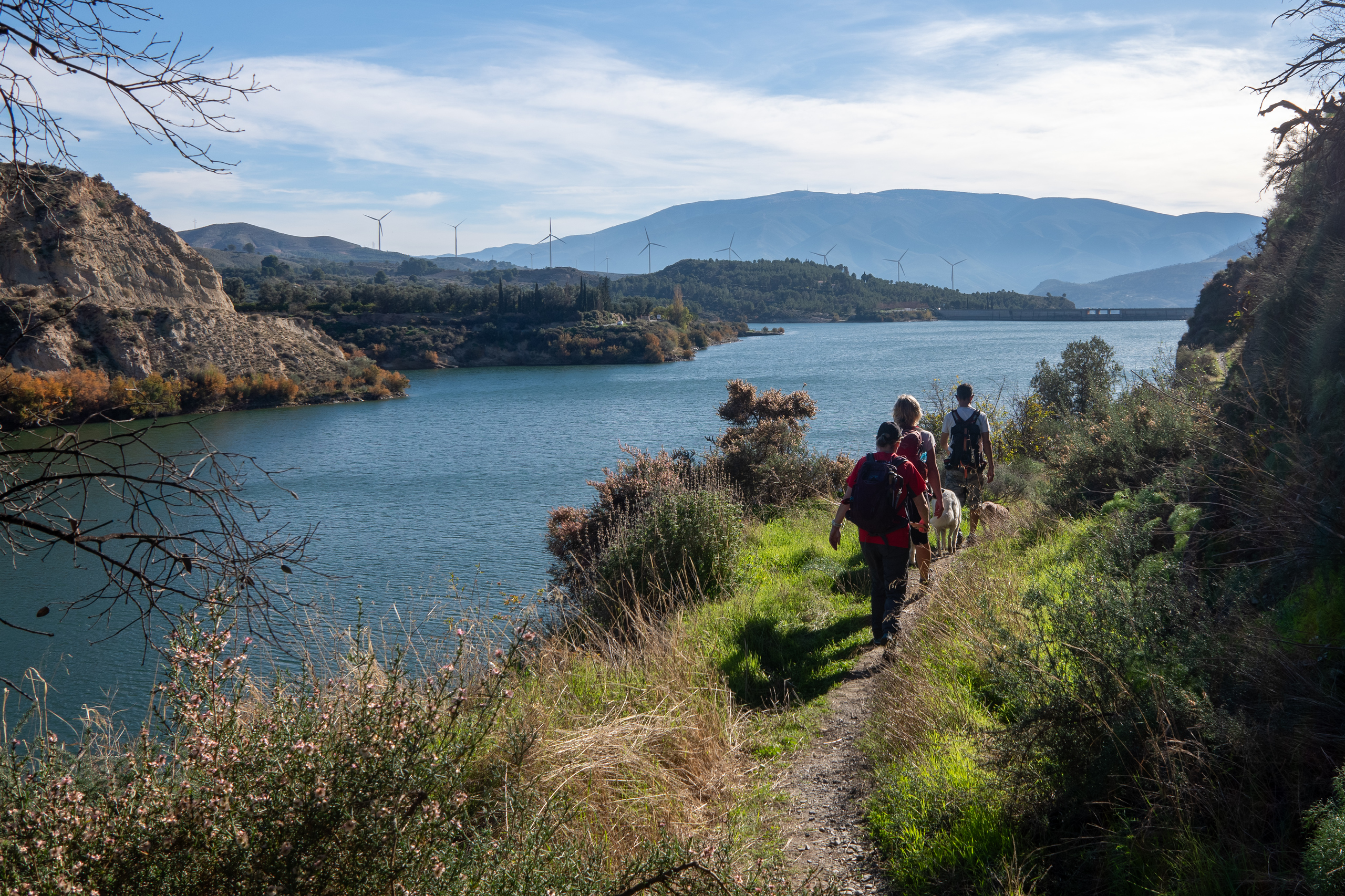
Barranco de Chite Circular
Lecrin Valley
Grade: Leisurely
Distance: 6 km
Ascent: 261 m
Time: 3 hrs
Optimal months: Mid-Sep to Mid-Jun
Map🗺️ - 3D⛰️ - Guide🔗 - Photos 📷
From Chite, the trail descends through terraced olive groves and citrus orchards, typical of the Lecrín Valley. The path leads directly to the shores of the Béznar Reservoir, offering panoramic views of the surrounding hills and the expansive water body.
The trail comes back through the picturesque Barranco de Chite Valley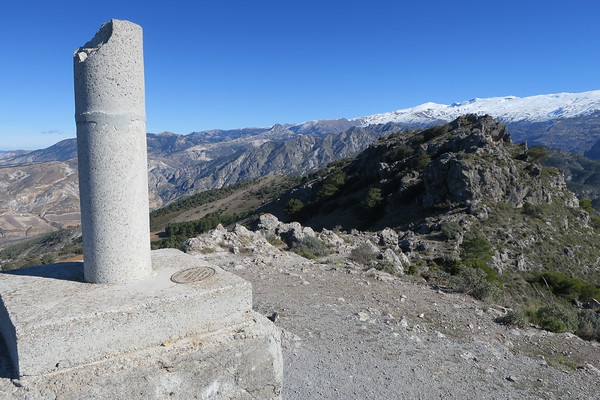
Silleta de Padul from Padul
Lecrin Valley
Grade: Moderate
Distance: 12 km
Ascent: 737 m
Time: 5 hrs
Optimal months: Mid-Sep to Mid-Jun
Map🗺️ - 3D⛰️ - Guide🔗 - Photos 📷
The Silleta de Padul, standing at 1,520 meters, is a prominent peak near Padul in the Sierra Nevada region of Spain. The name Silleta, translates to little saddle, reflecting its distinctive saddle-like shape.
The path ascends through diverse landscapes, including pine forests and open terrains. Hikers will encounter notable features such as the Piedra Ventana (Stone Window), a natural rock arch offering framed views of the Padul plains. The final approach to the summit involves a steady climb, leading to expansive 360° vistas of the Sierra Nevada, the Sierras de Alhama, Tejeda y Almijara, and the surrounding valleys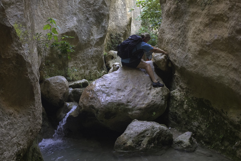
Barranco de la Luna
Lecrin Valley
Grade: Leisurely
Distance: 3 km
Ascent: 100 m
Time: 2 hrs
Optimal months: Jan to Dec incl
Map🗺️ - 3D⛰️ - Guide🔗 - Photos 📷
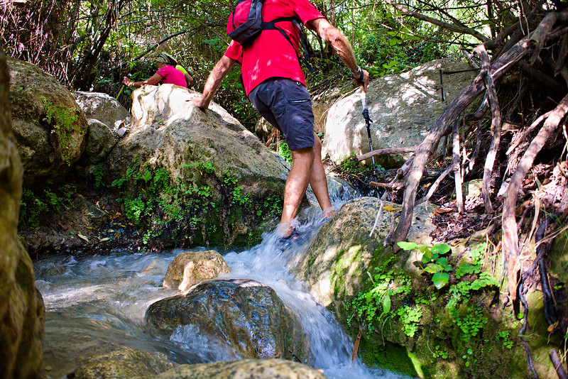
The gorge is characterized by its steep, narrow walls that, in some places, are just wide enough to pass through. The interplay of light and shadow within the canyon creates a mesmerizing atmosphere, making it a favorite spot for photographers.
Hikers will traverse sections of the riverbed, encountering clear pools and gentle streams. The cool waters provide a refreshing respite from the heat, especially during summer.
Barranco de Mizán Restabal
Lecrin Valley
Grade: Leisurely
Distance: 6 km
Ascent: 169 m
Time: 2 hrs
Optimal months: Mid-Sep to Mid-Jun
Map🗺️ - 3D⛰️ - Guide🔗 - Photos 📷
From Restábal, the trail ascends to the Ermita de la Virgen del Cerro, a local hermitage offering panoramic views of the Lecrín Valley and Sierra Nevada. Continuing, hikers enter the Barranco de Mizán, a picturesque ravine characterized by its lush vegetation and unique rock formations. The path then leads to the ruins of the Castillo de Restábal, also known as the Castillo de los Moros, a Nasrid-era fortress that, despite its current state of disrepair, provides a glimpse into the region's historical significance
River Walk Rio Santos, Albunelas
Lecrin Valley
Grade: Leisurely
Distance: 6 km
Ascent: 152 m
Time: 3 hrs
Optimal months: May to Nov incl
Map🗺️ - 3D⛰️ - Guide🔗 - Photos 📷
Cool, fun and unique! Enjoy spectacular half day walks both in and around the rivers in Granada Province of Andalucia.
The route starts and ends at the town of Albuñuelas where we park the cars. Then its down to the river valley where we start enter the water. The path winds it's way in and out of the river, avoiding difficult sections. There are a couple of boulders to scale but these are easy. It feels like you are exploring undiscovered sections of the Amazon! Always above your head is a green canopy of foliage and plants and insects rarely seen outside these environments are spotted. The half way stage arrives at a huge waterfall which provides for an entertaining shower! Some rails built into the rock provide a small challenge which is quikly overcome. Then it's back into the river and the narrowing gorge. At it's narrowest point the locals build a small dam, behind which lies a waist deep lake. This needs to be forded for us to continue our journey. We normally stop here for a swim and break.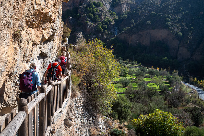
Niguelas Falla and Sendero Pavilla
Lecrin Valley
Grade: Leisurely
Distance: 5 km
Ascent: 150 m
Time: 2 hrs
Optimal months: Mid-Sep to Mid-Jun
Map🗺️ - 3D⛰️ - Guide🔗 - Photos 📷
The Falla de Nigüelas is a significant geological fault located near Nigüelas. Due to its geological importance and relatively recent formation, the Falla de Nigüelas was declared a Natural Monument.
The Sendero de la Pavilla is a scenic hiking trail that begins in Nigüelas and offers a relatively easy and family-friendly route. The trail largely follows an irrigation channel, known locally as an acequia, and provides hikers with stunning views of the Río Torrente gorge and the broader Valle de Lecrín. One of the trail's highlights is a section where the acequia passes between two closely set vertical rock walls, navigable via a metal grate installed over the channel. Along the route, hikers will encounter features such as a water distribution point that channels water towards the acequia de La Pavilla and the Valle de Lecrín, as well as a charming fountain fed by the acequia's waters.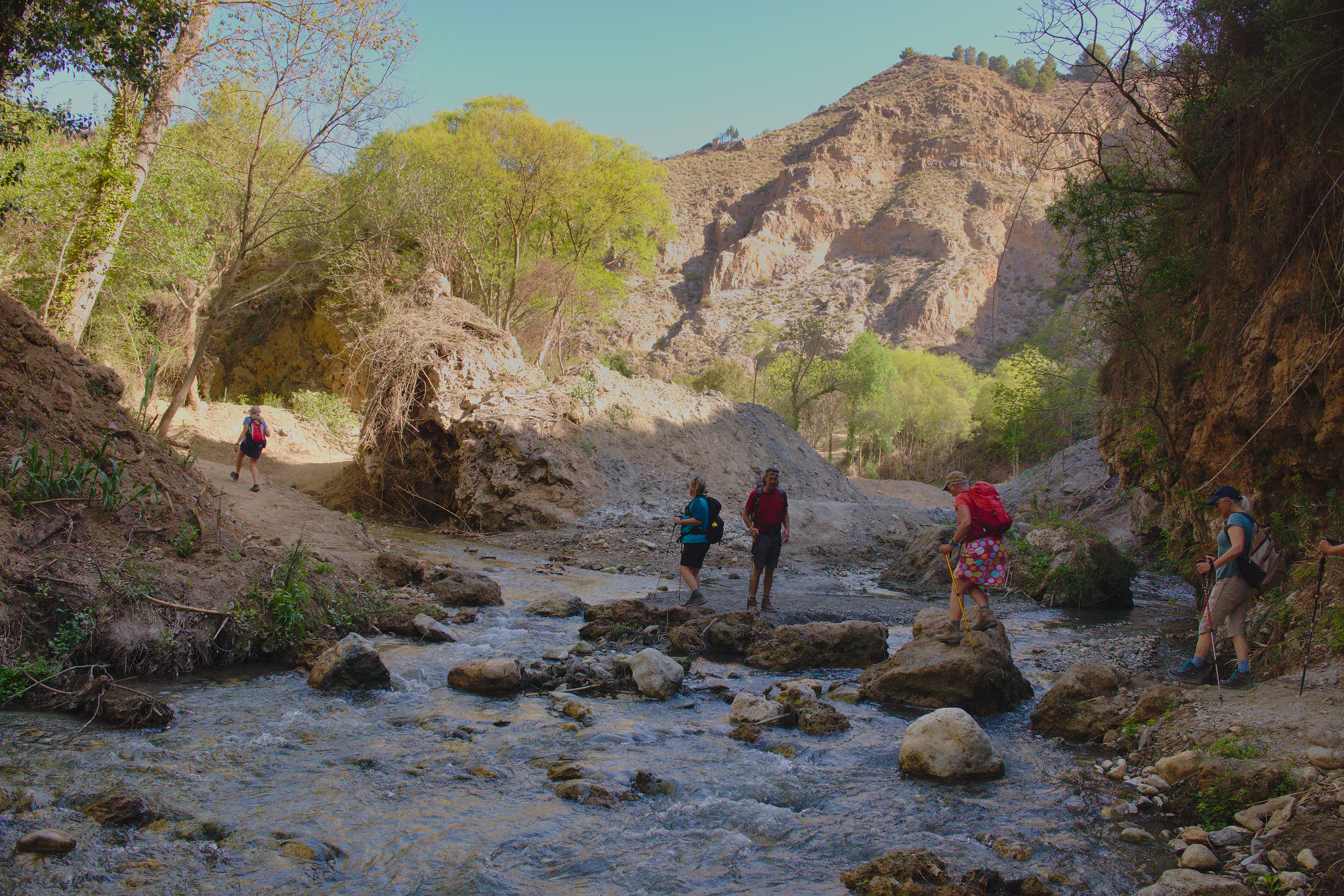
Fuentes de Conchar
Lecrin Valley
Grade: Moderate
Distance: 12 km
Ascent: 336 m
Time: 5 hrs
Optimal months: Mid-Sep to Mid-Jun
Map🗺️ - 3D⛰️ - Guide🔗 - Photos 📷
The trail traverses a mix of terrains, including lush valleys, vineyards, olive groves, and almond orchards. Hikers will also encounter cacti and scrubland, reflecting the region's rich biodiversity. Spectacular waterfalls too!
A notable highlight of the hike is the ascent to the Atalaya de Cónchar, an ancient watchtower offering panoramic views of the Lecrín Valley and the Sierra Nevada mountains. Along the route, hikers can visit the Baños de Urquízar, natural thermal springs with an average temperature of 24 degrees Celsius, providing a refreshing spot to relax.