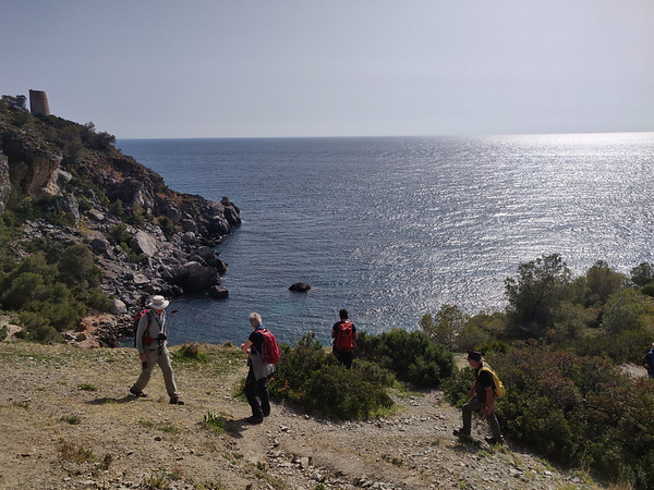
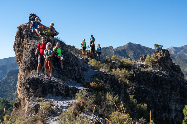
Coastal Walk - Cortijada Cantarriján
Sierra de Almijara
Grade: Leisurely
Distance: 5 km
Ascent: 345 m
Time: 3.5 hrs
Optimal months: Mid-Sep to Mid-Jun
Map🗺️ - 3D⛰️ - Guide🔗 - Photos 📷
The hike begins near Playa Cantarriján, a beach known for its clear waters and natural beauty. From here, the trail ascends through varied terrain, including pine forests and coastal scrub, leading to the traditional Andalusian farmhouse, Cortijada Cantarriján. Along the way, hikers are rewarded with panoramic views of the Mediterranean Sea and the rugged coastline.
For those seeking to extend their adventure, an additional loop leads to the Cerro Caleta, offering vistas of the surrounding cliffs and beaches. The descent from Cerro Caleta brings hikers to Playa del Cañuelo, a secluded beach perfect for a refreshing swim. The return journey traverses coastal paths back to the starting point, completing a circular route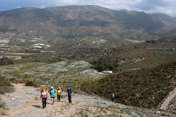
Cerro Toro and Cerro Gordo, Motril
Sierra de Almijara
Grade: Moderate
Distance: 11 km
Ascent: 488 m
Time: 4 hrs
Optimal months: Mid-Sep to Mid-Jun
Map🗺️ - 3D⛰️ - Guide🔗 - Photos 📷
The trail ascends from El Mirador, passing by landmarks such as the Túnel de la Gorgoracha and the Fuente de la Bullarenga. Hikers then proceed through the Barranco de las Provincias to the Parque Cerro del Toro, culminating at the Cerro del Toro summit.
The summit provides expansive views of Motril, its port, and the surrounding landscapes. The trail traverses diverse terrains, including forests, valleys, and water features, offering varied scenery.
Villages of los Guajares
Sierra de Almijara
Grade: Leisurely
Distance: 6 km
Ascent: 270 m
Time: 3 hrs
Optimal months: Mid-Sep to Mid-Jun
Map🗺️ - 3D⛰️ - Guide🔗 - Photos 📷
Circular route that begins in Guájar Fondón and leads hikers through the hills above the villages of Los Guájares. The hike starts with a steep ascent to El Castillejo, offering panoramic views of the surrounding area. The trail then descends, crossing the Río Toba, and continues into the village of Guájar Faragüit before looping back to the starting point in Guájar Fondón
Ventana de los Guajares, Molvizar
Sierra de Almijara
Grade: Challenging
Distance: 11 km
Ascent: 613 m
Time: 5 hrs
Optimal months: Mid-Sep to Mid-Jun
Map🗺️ - 3D⛰️ - Guide🔗 - Photos 📷
From Molvízar, hikers ascend via the Loma de los Pinillos, connecting to the Vereda del Minchar de Arriba. The path continues through varied terrains, including the Barranco Seco del Minchar and the Cuerda del Jaral, before reaching the Ventana de los Guájares. The descent leads through the Barranco del Búho, eventually returning to Molvízar.
Río Bacal Jayena - Sendero de los Arrieros
Sierra de Almijara
Grade: Challenging
Distance: 17 km
Ascent: 377 m
Time: 7 hrs
Optimal months: Jan to Dec incl
Map🗺️ - 3D⛰️ - Guide🔗 - Photos 📷
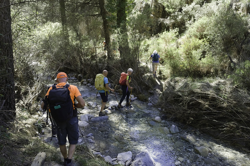
Embarking on the Río Bacal and Sendero de los Arrieros hike near Jayena offers a captivating journey through the natural beauty of the Sierras de Tejeda, Almijara, and Alhama Natural Park. This trail combines serene river landscapes, historical pathways, and panoramic vistas, making it a memorable experience for outdoor enthusiasts.
The Lentegi Skyline
Sierra de Almijara
Grade: Moderate
Distance: 12 km
Ascent: 280 m
Time: 5 hrs
Optimal months: Mid-Sep to Mid-Jun
Map🗺️ - 3D⛰️ - Guide🔗 - Photos 📷
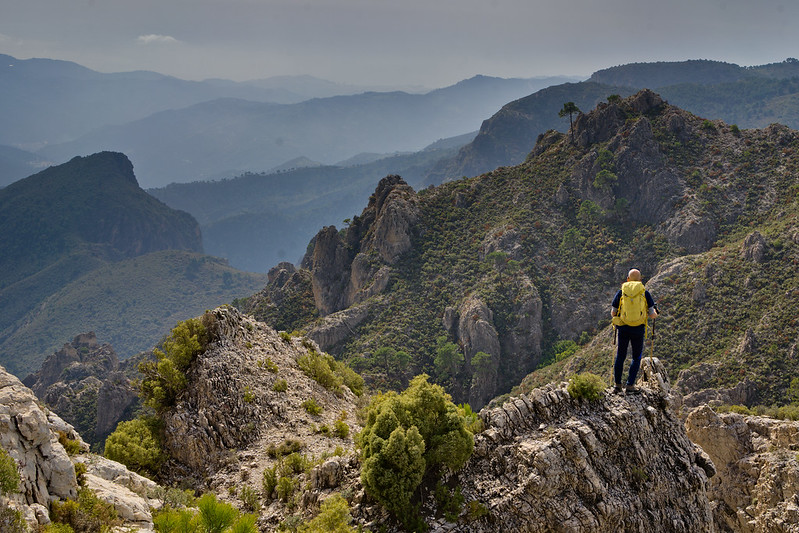
Exploring the ridges above the village of Lentegí in Andalusia offers hikers a chance to experience the rugged beauty of the Sierra de Almijara. This region is characterized by steep limestone formations, dense pine forests, and panoramic views of the Mediterranean coastline.
Pico Lopera
Sierra de Almijara
Grade: Moderate
Distance: 9 km
Ascent: 269 m
Time: 5 hrs
Optimal months: Mid-Sep to Mid-Jun
Map🗺️ - 3D⛰️ - Guide🔗 - Photos 📷
From the trailhead, the path ascends steadily through a landscape characterized by typical Mediterranean vegetation. The trail is well-marked but can be rocky in sections, so sturdy footwear is recommended.
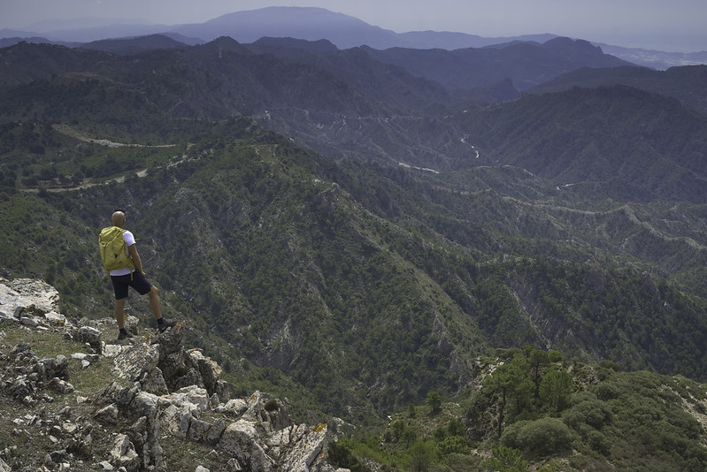
Upon reaching the summit at 1,481 meters, hikers are rewarded with expansive views of the surrounding sierras and valleys. The vantage point provides a unique perspective of the rugged terrain and, on clear days, glimpses of the Mediterranean Sea. The descent follows a looped path that brings hikers back to the starting point, offering different scenery and perspectives along the way.
Circular Lentegi PR440
Sierra de Almijara
Grade: Challenging
Distance: 16 km
Ascent: 697 m
Time: 6 hrs
Optimal months: Mid-Sep to Mid-Jun
Map🗺️ - 3D⛰️ - Guide🔗 - Photos 📷
Embarking on the PR-A 440 Jaloche - Cortijo de Lizardo trail offers hikers a challenging yet rewarding experience in the picturesque landscapes surrounding Lentegí, Granada. This circular route is renowned for its diverse terrains, scenic vistas, and cultural landmarks.
Petrified Waterfall Rio Verde
Sierra de Almijara
Grade: Moderate
Distance: 9 km
Ascent: 414 m
Time: 5 hrs
Optimal months: Mid-Sep to Mid-Jun
Map🗺️ - 3D⛰️ - Guide🔗 - Photos 📷
Hiking to the Petrified Waterfall in the Río Verde area near Otívar, Granada, offers an enriching experience that combines natural beauty with a touch of geological intrigue. This trail is renowned for its scenic landscapes, including the unique petrified waterfall where mineral-rich waters have fossilized tree trunks over time.
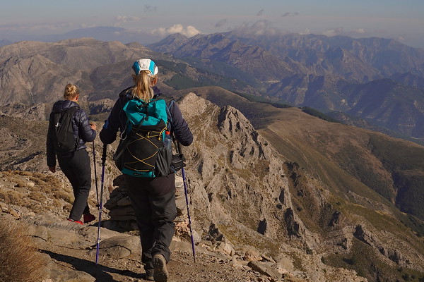
La Maroma from the north
Sierra de Almijara
Grade: Tough
Distance: 16 km
Ascent: 965 m
Time: 7 hrs
Optimal months: Jan to Dec incl
Map🗺️ - 3D⛰️ - Guide🔗 - Photos 📷
Hiking La Maroma (2,066 m) — the highest peak in the Sierra de Tejeda — from the north is a spectacular and lesser-traveled approach to this iconic summit. Unlike the more popular southern route from Canillas de Aceituno, the northern route offers alpine forest, solitude, and impressive views over the Arenas del Rey and Alhama de Granada areas.
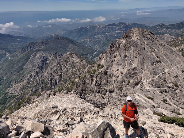
Cerro Lucero
Sierra de Almijara
Grade: Challenging
Distance: 11 km
Ascent: 858 m
Time: 6 hrs
Optimal months: Jan to Dec incl
Map🗺️ - 3D⛰️ - Guide🔗 - Photos 📷
Climbing Cerro Lucero (also known as Raspón de los Moriscos, 1,779 m) from the north side offers a wild and beautiful hike through the remote heart of the Sierra Almijara, with panoramic views stretching from the Mediterranean coast to the Sierra Nevada. This northern route is more adventurous and less frequented than the popular southern approach from La Resinera or Competa.