Routes, Maps & Inspiration for Self Guided Walking & Hiking in Spain's Sierra Nevada
N.B This is an interactive map that opens up in new window
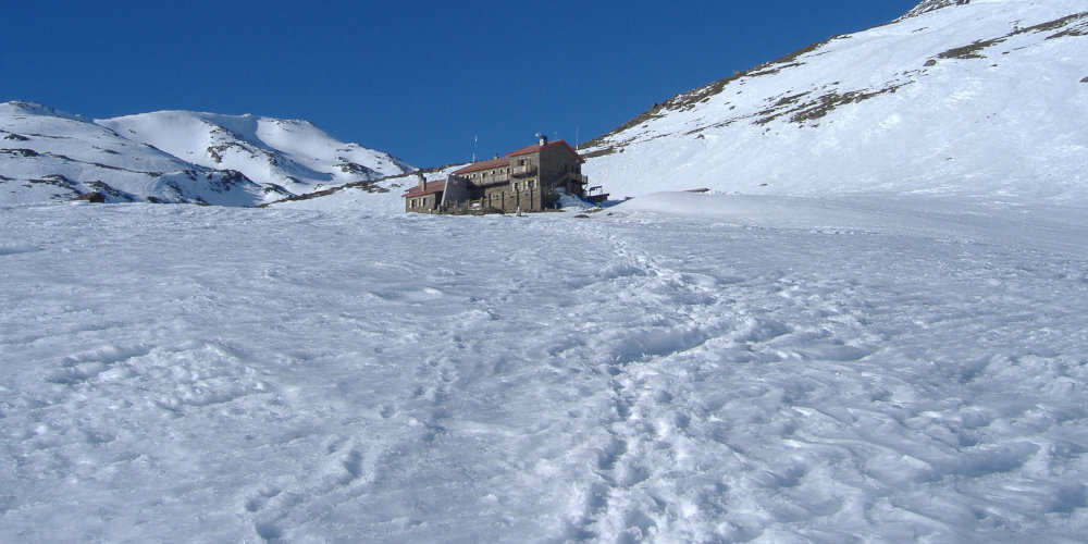
Day 1 - Ascend to Refugio Poqueira (2500m) 4 hours via the Barranco de Poqueira (900m ascent). Stay the night at the hut. The Poqueira Hut is a guarded refuge and has beds, blankets, meals and wine. A great place to spend the night before ascending the peak
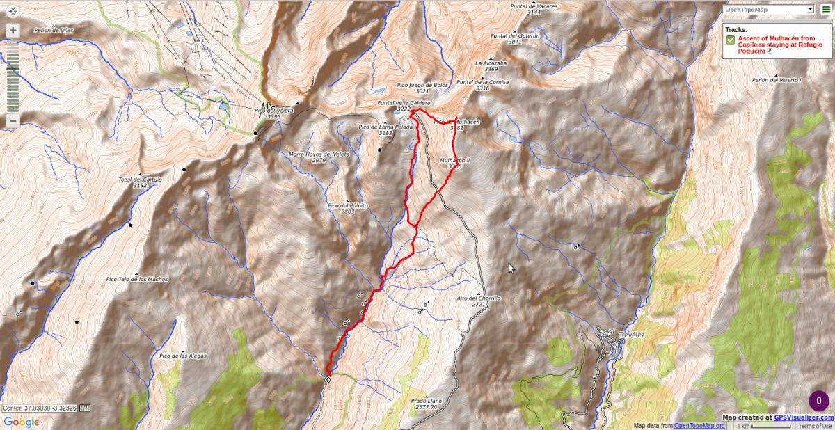
Day 2 - via the Rio Mulhacen to the Col del Ciervo and a superb view over the magnificent north face. West flank to the summit. Return via south ridge to refugio and retrace outward journey to Cebedilla and Capileira.
Recommended map: Parque Nacional de Sierra Nevada 1:40000 www.penebetica.com

Want some help? Find a guide? CONTACT US
KNOWLEDGE BASE
Mountain database, refuges, altitude sickness, avalanche dangers, equipment lists, gear rental, FAQs etc
Contact us via our Contact Page Spanish Highs Tours Ltd Head Office:
41 Axholme Drive,
Epworth,
DN91EL,
North Lincolnshire,
UK.
Registered Office: 20-22 Wenlock Road, London, N1 7GU, England © 2019 sierranevada.guide
info@spanishhighs.co.uk
Company Number 09960909 Registered in England & Wales