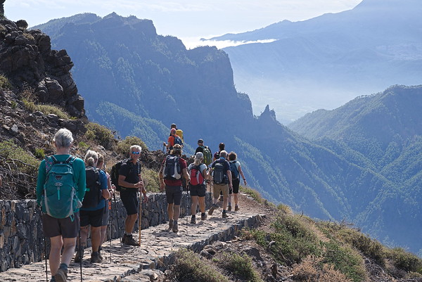
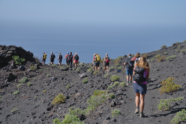
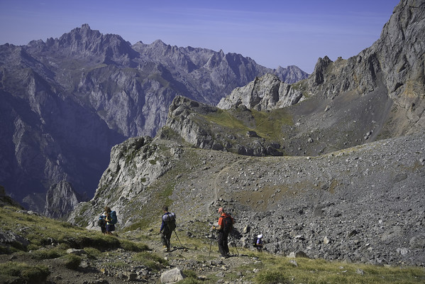
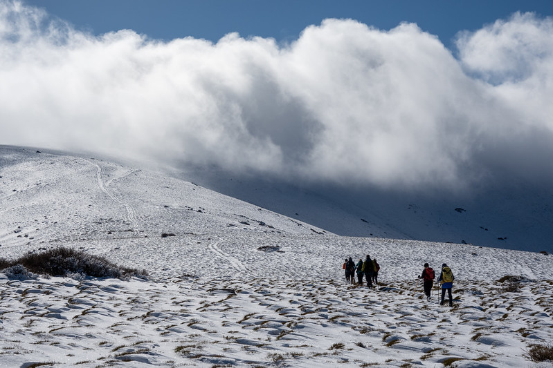
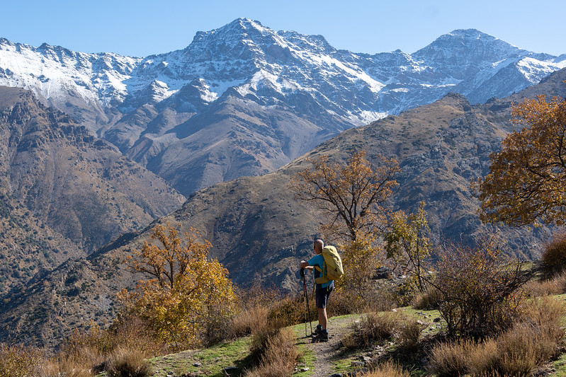
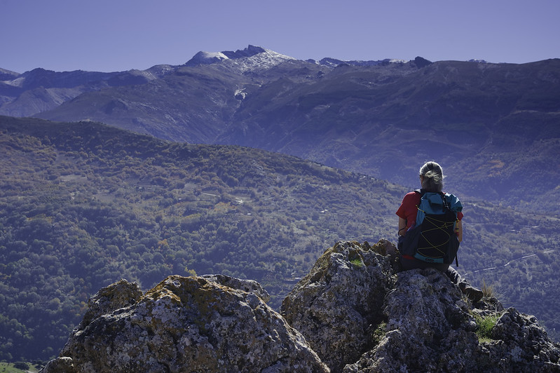
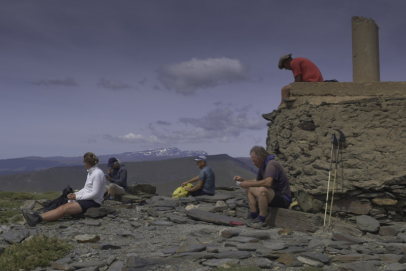
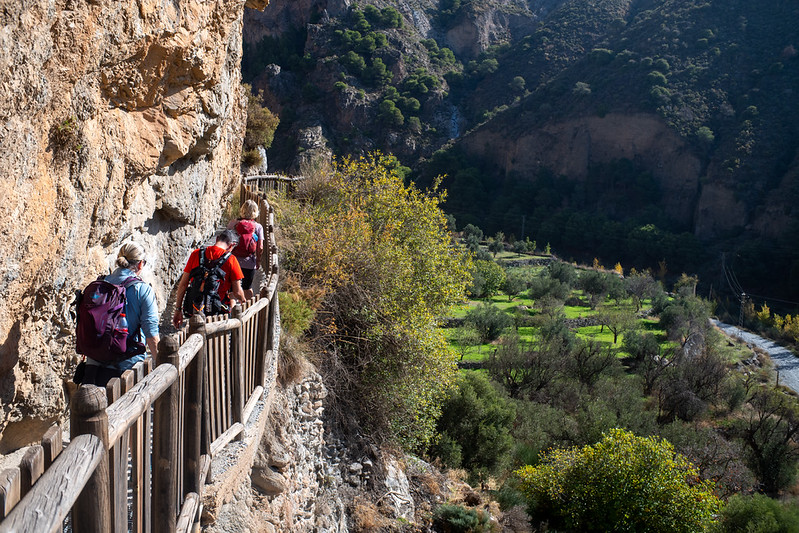
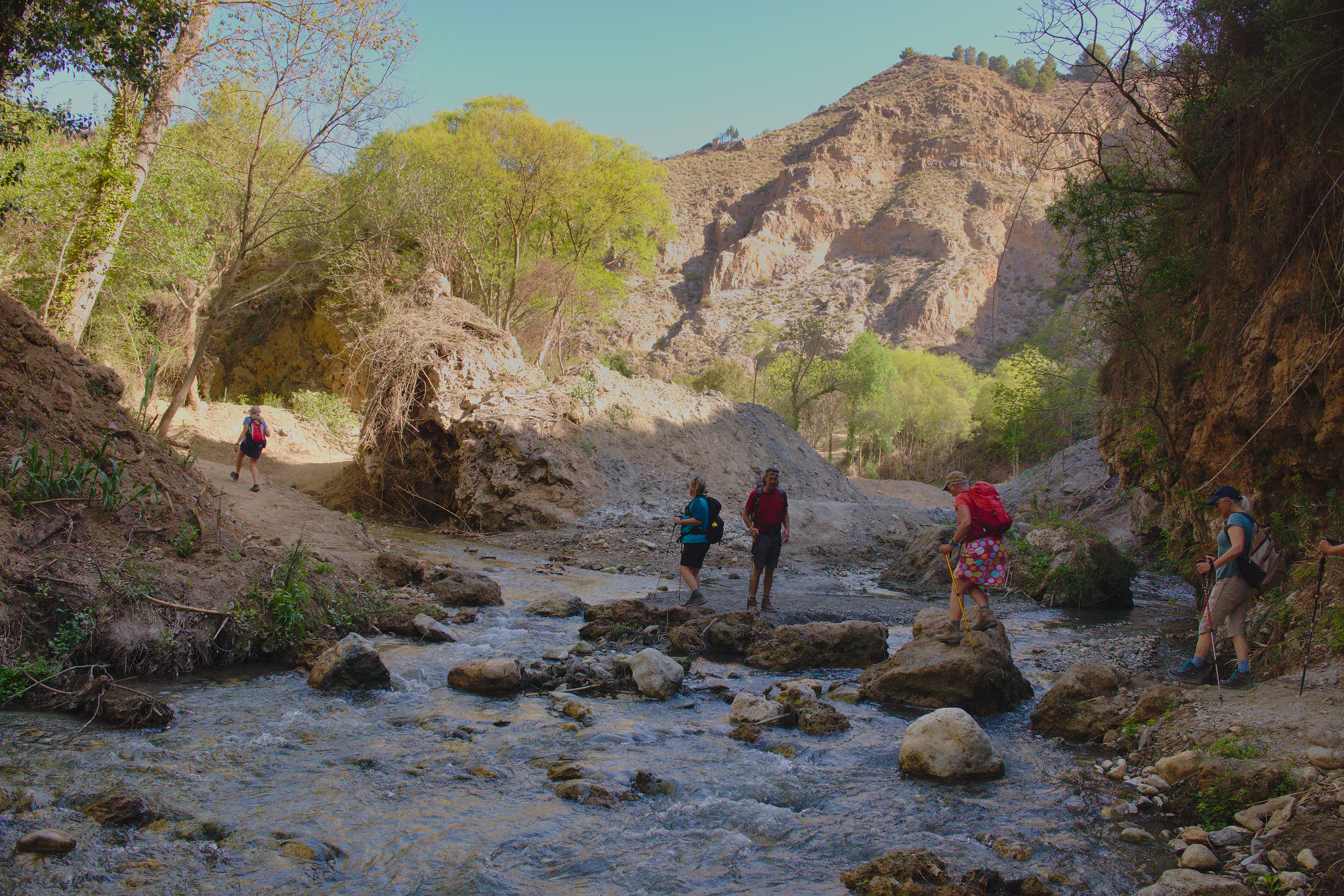
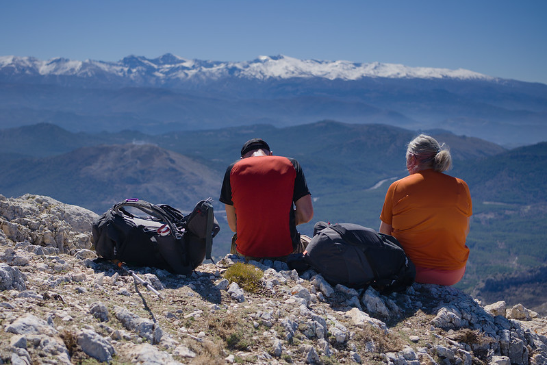
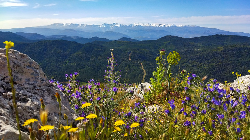
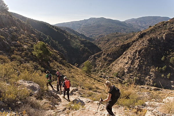
If you’re a hiker or trekker looking for inspiration to explore the Alpujarras, Sierra Nevada, and the surrounding areas, you’re in the right place. We’ve personally done all these routes, so you know they’re tried and tested. We’ve also thrown in some of our trips to La Palma and the Picos de Europa for extra adventure.
This isn’t meant to replace a full guidebook — you’ll get detailed route maps, a 3D representation and some great photos, but just brief notes to help you along. Use our Walk and Trek Finder below to browse the site and pick the perfect hike for you. And if you’d rather have a guide with you, no problem! We can hook you up with one of our local, English-speaking experts.
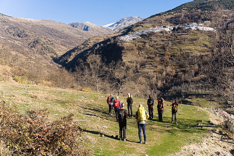
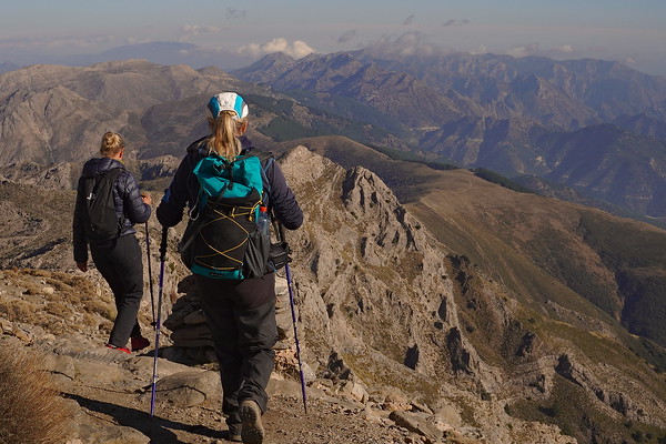
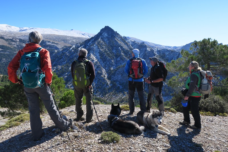
White Villages of the Poqueira
Alpujarras
Grade: Challenging
Distance: 10 km
Ascent: 544 m
Time: 5 hrs
Optimal months: Mid-Sep to Mid-Jun
Map🗺️ -
3D⛰️ -
Guide🔗 -
Photos 📷
ℹ️ Read more
The three white hill villages of Capileira, Bubion and Pampaneira sit on hillsides above the dramatic Poqueira gorge. Mulhacen, at 3482m rises above the towns. This walk links all three of these villages and crosses the gorge twice.,A start is made from the highest of the villages, Capileira. The trail drops down to cross the Rio Poqueira via a small bridge. Then its an undulating traverse on the west side of the river before dropping down, recrossing the river and climbing up to the village of Capileira.,After a brief stop (maybe to visit a bodega!), we head steeply uphill through the village, exiting at the top before continuing the journey to Bubion. From Bubion it is then another 30 mins to reach the end at Capileira.
×
Ancient Waterways and Gorges of Lanjaron
Alpujarras
Grade: Challenging
Distance: 12 km
Ascent: 621 m
Time: 6 hrs
Optimal months: Mid-Sep to Mid-Jun
Map🗺️ -
3D⛰️ -
Guide🔗 -
Photos 📷
ℹ️ Read more
No need for transport today! The walk starts and ends from your hotel. It is very varied circular walk that has proved to be very popular with clients. We first visit the Arab Castle and walk along the cliff tops of the Tajos de Colorao opposite.,A short climb and we reach the Ermita of the Tajos de la Crux. This is a magniificent mirador which overlooks the town. We traverse land northwards and reach the Camino de las Sierras, an old drove trail to the mountains. This will follow until we can take a faint track which traverse down to cross the Rio Lanjaron by an old bridge.,A superb section follows consisting of a series of beautiful irrigation channels and chestnut woods before we drop steeply back down to the hotel in Lanjaron.
×
The Medieval Way - Taha del Pitres Villages
Alpujarras
Grade: Moderate
Distance: 9 km
Ascent: 424 m
Time: 5 hrs
Optimal months: Mid-Sep to Mid-Jun
Map🗺️ -
3D⛰️ -
Guide🔗 -
Photos 📷
ℹ️ Read more
A lovely drive through the Alpujarras brings us to the Taha de Pitres region. This is an area characterised by small white villages, steep sided gorges and abundant flora and fauna.,Most of this walk we are follow old medieval trails through the hills and villages. We start in Mecina Fondales and drop down to the enchanting village of Fondales. Here we turn east and head for Ferrierola, perched high above the Trevelez gorge.,Then it's uphill to visit the very quaint, Atalbeitar before rising to reach the road that leads us to the town of Portugos. We take quiet back tracks to Pitres before dropping steeply back down to the start point at Mecina.
×
GR240 High Forests of the Alpujarras
Alpujarras
Grade: Moderate
Distance: 11 km
Ascent: 207 m
Time: 5 hrs
Optimal months: Mid-Sep to Mid-Jun
Map🗺️ -
3D⛰️ -
Guide🔗 -
Photos 📷
ℹ️ Read more
We drop you off at the Forest Station at Hoya del Portillo. Then it's up through the pine forests to break out onto open hillside and arrive at the Puerta del Molina. This is a superb viewpoint of the Sierra Nevada and all the main peaks cam be seen.,We drop back down on a dirt track before joining up with the long distance path, the Sulayr,GR240. We drop down through gorgeous forested hillsides and all the way back for a cold celebration cold drink in the village of Capileira. A totally enjoyable, different and engaging day!
×
Bordaila - Acequia Nueva
Lanjaron
Grade: Challenging
Distance: 11 km
Ascent: 840 m
Time: 6 hrs
Optimal months: Mid-Sep to Mid-Jun
Map🗺️ -
3D⛰️ -
Guide🔗 -
Photos 📷
ℹ️ Read more
The hike begins in Lanjarón, ascending through the Barranco del Río Lanjarón along a cobbled path leading to the Casa Forestal de Tello. This section offers panoramic views of the valley, the high peaks of Sierra Nevada, and the distant coastline. Along the way, hikers will encounter grand castaños (chestnut trees), cross the Río Lanjarón in a secluded and lush setting, and return to Lanjarón alongside the Acequia Montalbán, walking along its edge and passing by a picturesque waterfall.
×
Coastal Walk - Cortijada Cantarriján
Sierra de Almijara
Grade: Leisurely
Distance: 5 km
Ascent: 345 m
Time: 3.5 hrs
Optimal months: Mid-Sep to Mid-Jun
Map🗺️ -
3D⛰️ -
Guide🔗 -
Photos 📷
ℹ️ Read more
The hike begins near Playa Cantarriján, a beach known for its clear waters and natural beauty. From here, the trail ascends through varied terrain, including pine forests and coastal scrub, leading to the traditional Andalusian farmhouse, Cortijada Cantarriján. Along the way, hikers are rewarded with panoramic views of the Mediterranean Sea and the rugged coastline.,For those seeking to extend their adventure, an additional loop leads to the Cerro Caleta, offering vistas of the surrounding cliffs and beaches. The descent from Cerro Caleta brings hikers to Playa del Cañuelo, a secluded beach perfect for a refreshing swim. The return journey traverses coastal paths back to the starting point, completing a circular route
×
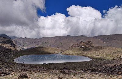
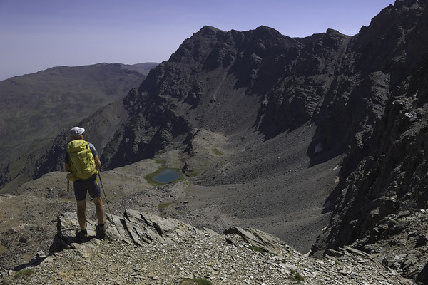
Veleta 3394m & mountain lakes
Sierra Nevada Summits
Grade: Moderate
Distance: 10 km
Ascent: 350 m
Time: 5.5 hrs
Optimal months: May to Nov incl
Map🗺️ -
3D⛰️ -
Guide🔗 -
Photos 📷
ℹ️ Read more
A summer hike up Veleta (3,394 meters), one of the highest peaks in Spain, and then down to the Lagunillas de la Virgen (and surrounding lakes) in the Sierra Nevada is absolutely stunning—both in scenery and experience.,At the summit, you get breathtaking panoramic views—you can see across the entire Sierra Nevada range, and on a clear day, even Africa across the Mediterranean. After the summit, heading southwest, the terrain gradually becomes more alpine-meadow-like as you descend toward the Lagunillas (Lagunillas de la Virgen and others).,The descent path is often dotted with wildflowers, mountain goats (cabras montesas), and sometimes patches of lingering snow. The lakes are glacial and beautifully blue, nestled in a dramatic bowl surrounded by peaks like Cerro de los Machos and Tajos de la Virgen.
×
Cerro los Machos 3329m, Coral del Veleta
Sierra Nevada Summits
Grade: Moderate
Distance: 7 km
Ascent: 520 m
Time: 5 hrs
Optimal months: May to Nov incl
Map🗺️ -
3D⛰️ -
Guide🔗 -
Photos 📷
ℹ️ Read more
Cerro de los Machos, standing at 3,329 meters, is one of the prominent peaks in Spain's Sierra Nevada. The hike to its summit offers adventurers a chance to experience breathtaking vistas, challenging terrains, and a touch of the region's rich history,Corral del Veleta: A dramatic glacial cirque nestled beneath the imposing cliffs of Veleta.,Panoramic perspectives encompassing the Sierra Nevada range, including the highest peak, Mulhacén, and on clear days, views stretching to the Mediterranean Sea and even the mountains of North Africa.
×
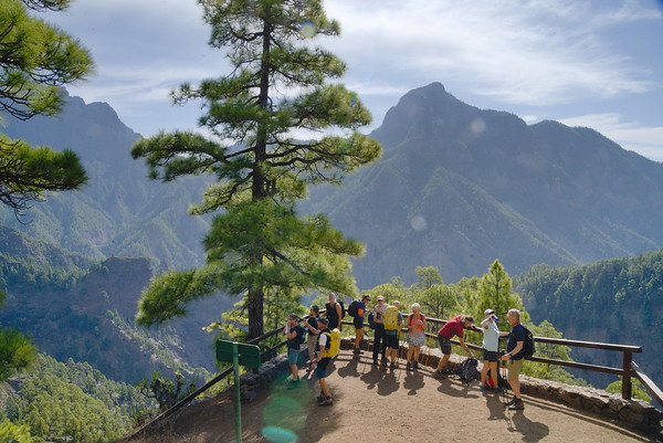
Rim of the Caldera de Taburiente
La Palma
Grade: Moderate
Distance: 13 km
Ascent: 456 m
Time: 6 hrs
Optimal months: Mid-Sep to Mid-Jun
Guide🔗 -
Photos 📷
ℹ️ Read more
To get to the starting point of this spectacular walk you'll be taken up by private bus from sea level and through all five different vegetation levels, to the highest peak of the island (Roque de Los Muchachos). From here we first walk over a viewing point and later along the highest rim of the Island.,After visiting the superb viewing platform of the Espigon del Roque (2382m), we shall cover the peaks of Roque de los Muchachos (2426m), Pico de la Cruz (2351m), Piedra Llana (2314m) and Pico de la Nieve (2232m) before dropping down to a meeting point with the bus. This whole rim of the Caldera gives relatively easy walking on good, but sometimes rough paths with always spectacular views on the right hand side down into the crater.,This is a superb first day walk which will help orientate you to the island. It will give us a birdsview over La Palma all the way over to the neighbouring islands of Tenerife, La Gomera and El Hierro. The National Park of Caldera de Taburiente and it's huge crater will be at our feet.
×
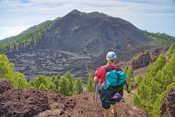
Ruta de los Volcanes
La Palma
Grade: Challenging
Distance: 15 km
Ascent: 797 m
Time: 7 hrs
Optimal months: Mid-Sep to Mid-Jun
Guide🔗 -
Photos 📷
ℹ️ Read more
In our opinion this walk this is a highlight of the island. It visits lots of extinct volcanoes along the central rim of Cumbre Vieja. Just an incredible days hiking in spectacular scenery that is just so unusual and outside of most peoples experience. A must-do walk!,We start at the visitor center at Area Recreativa El Pilar. From here we skirt Pico Birigoya and rise slowly through the trees until we reach the huge crater at Hoya Negro and Pico Nambroque, which exploded in 1949.,Then its onto view the huge lava fields of Maltorada before climbing to the crater and peak of Volcan de la Deseada (1945m). From there a gentle descent past Volcan Cabrito brings us to the crater of Volcan Martin (1529m). We descend through sandy lava fields on good tracks to our waiting transport at the Refugio Fuente de los Roques.
×
Ruta Agusturias
La Palma
Grade: Moderate
Distance: 14 km
Ascent: 193 m
Time: 5.5 hrs
Optimal months: Mid-Sep to Mid-Jun
Guide🔗 -
Photos 📷
ℹ️ Read more
Another spectacular transfer takes us to a magnificent viewpoint right into the huge erosion crater of the National Park. The steep windy road zig zags continuously up the gorge to arrive at the Mirador de los Brecitos (1030m).,We leave the bus here and walk down into the very heart of the crater on superb paths surrounded by steep walls. Around and above us rise the peaks along the rim of the Caldera de Taburiente that we visited on our first hike. Truly dramatic scenery!,We arrive at the Playa de Taburiente where we can take a lunch break and admire the scenery. Then its down through steep forest tracks to join the river at the Barranco de Angustias. Once down we have the option to visit the waterfall of colours and then we follow the valley downstream through the gorge of Angustias to the finish.
×
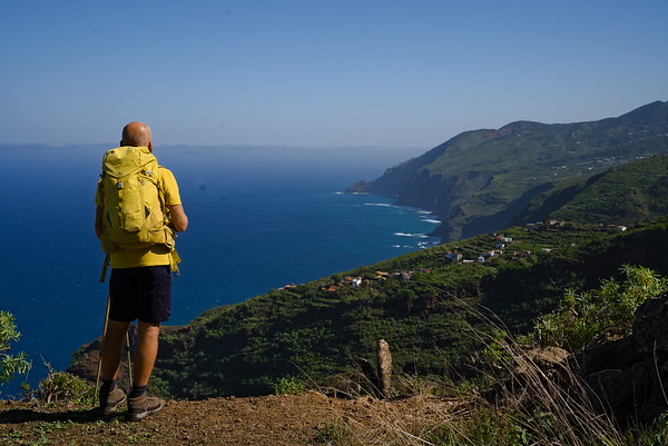
The Wild North and El Tablado Coast
La Palma
Grade: Moderate
Distance: 9 km
Ascent: 362 m
Time: 5 hrs
Optimal months: Mid-Sep to Mid-Jun
Guide🔗 -
Photos 📷
ℹ️ Read more
Another diverse walk today. A beautiful transfer will show us a big part of the north eastern part of the island. The walk starts in one of Europes last big laurel forests at the Centro de Visitantes La Zarza. We drop down into the rain forests of the Barranco Magdelena where impressive trees and huge ferns accompany us. All of a sudden the view opens up as we rise up out of the Barranco and we are allowed a view over the rugged northern coast of La Palma with its numerous deep canyons.,We drop down to the east of the hamlet of Don Pedro to the Mirador de la Calzada. This is a superb viewpoint over the coast. From here we can see the route ahead. A very steep, rocky but well graded path leads down in a series of zig zags to the valley bottom just above the sea. What follows is a tough ascent but we take it slow and it is on a good path. This brings us to the tiny hamlet of El Tablado, where time seems to have stopped 60 years ago. Maybe we can convince the small bar to open for us? Our bus picks us up just above the village.
×
The Southern Volcanoes
La Palma
Grade: Moderate
Distance: 15 km
Ascent: 253 m
Time: 6 hrs
Optimal months: Mid-Sep to Mid-Jun
Guide🔗 -
Photos 📷
ℹ️ Read more
A short transfer leads to the south west of the island. We start at the Mirador de Charca where we follow the long distance GR130 track through pine forests and alongside vineyards. With constant wonderful views towards the coast we arrive near the village of Fuencaliente, home of the largest winery of the island. ,The excitement builds as we start to descend into volcanic territory, walking towards the coast. The good path descends gradually all the way down to the lighthouse. On our the way down we are able to have a look at the crater of the Teneguia volcano (exploded in 1971) and walk its through incredible lava fields that stretch down to the lighthouse. Here, nature is only now starting to get a grip back into the landscape. An experience not to be missed.
×
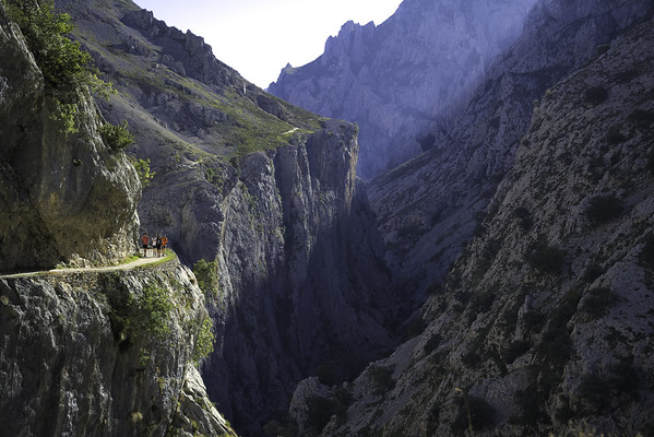
The Garganta de Cares
Picos de Europa
Grade: Moderate
Distance: 22 km
Ascent: 469 m
Time: 7 hrs
Optimal months: Mid-Sep to Mid-Jun
Guide🔗 -
Photos 📷
ℹ️ Read more
This is an out and back route from Poncebos (26km), unless transport can be arranged at Caín de Valdeon (where there is a nice bar!). As it is out and back. It gives the opportunity for a shorter day, which is nice if you just wish to sit and enjoy the gorge. The gorge is utterly spectacular and dramatic. An early start will reward when the light isn't so harsh.
×
Around Monte Camba, Sotres to Tielve
Picos de Europa
Grade: Moderate
Distance: 13 km
Ascent: 650 m
Time: 5 hrs
Optimal months: Mid-Sep to Mid-Jun
Guide🔗 -
Photos 📷
ℹ️ Read more
We did this hike as the holiday weekend crowds had closed the road to the Urriellu area. This was an impromptu alternative. Glad we did it as it gave us a glimpse of pretty alpine meadows and sleepy hamlets with distant views to the dramatic Naranja de Bulnes and other peaks. Too hot to complete the circular from Tielve so we sat in a bar instead and had some cold drinks.
×
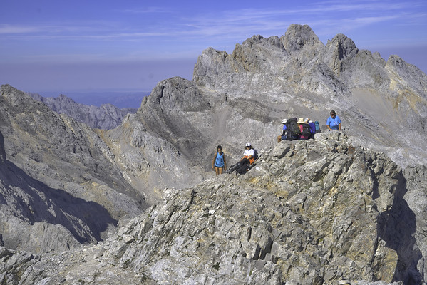
Cabaña Verónica and Torre de Horcados Rojos
Picos de Europa
Grade: Challenging
Distance: 11 km
Ascent: 960 m
Time: 7 hrs
Optimal months: Mid-Sep to Mid-Jun
Guide🔗 -
Photos 📷
ℹ️ Read more
We used the cable car from Fuente Dé for access to the high mountains. A spectacular hike to the remarkable Refugio Cabaña Verónica, perched precariously on a rocky ridge. Then a loose scramble up from a col to the fine summit off the Torre de Horcados Rojos (2503m), seemingly overlooking the world!
×
To the Refugio Collado Jermoso
Picos de Europa
Grade: Challenging
Distance: 8 km
Ascent: 950 m
Time: 6 hrs
Optimal months: Mid-Sep to Mid-Jun
Guide🔗 -
Photos 📷
ℹ️ Read more
From the top of the Fuente Dé cable car we had to hike 8km with 1000m of ascent over the mountains to the west, crossing the Colladina de las Nieves and the small passes at Las Colladinas. This is a very spectacular walk although care would be needed in mist as the trail is quite rocky.,Arrival at the beautifully situated refuge is always a joy to behold. At the Refugio Collado Jermoso conditions were almost perfect for enjoying the beautiful sunset and stunning early morning cloud inversions. This is a beautiful mountain refuge if you ever get the opportunity to stay here.
×
Refugio Jermoso to Fuente De
Picos de Europa
Grade: Challenging
Distance: 9 km
Ascent: 580 m
Time: 5 hrs
Optimal months: Mid-Sep to Mid-Jun
Guide🔗 -
Photos 📷
ℹ️ Read more
A spectacular morning departure from the refuge with cloud inversion until this all cleared at the Las Colladinas. Then it was a rough descent to the green, lush valley of the Vega de Liordes. Beautiful views of the surrounding mountain summits. We past some ancient mines before descending the steep zig-zags back to Fuente Dé. How on earth did they make that incredible path?
×
Cerro Toro and Cerro Gordo, Motril
Sierra de Almijara
Grade: Moderate
Distance: 11 km
Ascent: 488 m
Time: 4 hrs
Optimal months: Mid-Sep to Mid-Jun
Map🗺️ -
3D⛰️ -
Guide🔗 -
Photos 📷
ℹ️ Read more
The trail ascends from El Mirador, passing by landmarks such as the Túnel de la Gorgoracha and the Fuente de la Bullarenga. Hikers then proceed through the Barranco de las Provincias to the Parque Cerro del Toro, culminating at the Cerro del Toro summit.,The summit provides expansive views of Motril, its port, and the surrounding landscapes. The trail traverses diverse terrains, including forests, valleys, and water features, offering varied scenery.
×
Camino Mozarabe
Granada
Grade: Leisurely
Distance: 12 km
Ascent: 356 m
Time: 4 hrs
Optimal months: Mid-Sep to Mid-Jun
Map🗺️ -
3D⛰️ -
Guide🔗 -
Photos 📷
ℹ️ Read more
The Camino Mozárabe is a historic pilgrimage route that connects the southeastern regions of Spain to Santiago de Compostela. The segment from Dúdar to Granada is a picturesque portion of the Camino Mozárabe, offering pilgrims a blend of natural beauty and cultural landmarks.,Why Choose Camino Mozárabe near Granada? Cultural Richness: Offers a deeper understanding of Andalusia’s complex history through tangible cultural heritage. Authenticity: Less crowded compared to other popular Camino routes, allowing for reflection and genuine interaction with locals. Natural Beauty: Stunning landscapes featuring olive groves, mountains, and traditional villages.
×
Morron Sanjuanero and Morron Hornillo
Sierra Nevada Summits
Grade: Moderate
Distance: 9 km
Ascent: 606 m
Time: 4 hrs
Optimal months: May to Nov incl
Map🗺️ -
3D⛰️ -
Guide🔗 -
Photos 📷
ℹ️ Read more
Ascent to Morrón del Hornillo (2,375 m): From Puerto de la Ragua, hikers embark on a trail that ascends through reforested pine areas. The path may become less distinct as the tree line thins, but stone cairns often guide the way. Upon reaching the summit, adventurers are rewarded with expansive views of the surrounding landscapes.,Proceeding to Morrón Sanjuanero (2,610 m): Continuing along the ridge, the trail leads to Morrón Sanjuanero. This segment involves a steady ascent and offers hikers the opportunity to experience the unique flora and fauna characteristic of the high Sierra Nevada.
×
Villages of los Guajares
Sierra de Almijara
Grade: Leisurely
Distance: 6 km
Ascent: 270 m
Time: 3 hrs
Optimal months: Mid-Sep to Mid-Jun
Map🗺️ -
3D⛰️ -
Guide🔗 -
Photos 📷
ℹ️ Read more
Circular route that begins in Guájar Fondón and leads hikers through the hills above the villages of Los Guájares. The hike starts with a steep ascent to El Castillejo, offering panoramic views of the surrounding area. The trail then descends, crossing the Río Toba, and continues into the village of Guájar Faragüit before looping back to the starting point in Guájar Fondón
×
Ventana de los Guajares, Molvizar
Sierra de Almijara
Grade: Challenging
Distance: 11 km
Ascent: 613 m
Time: 5 hrs
Optimal months: Mid-Sep to Mid-Jun
Map🗺️ -
3D⛰️ -
Guide🔗 -
Photos 📷
ℹ️ Read more
From Molvízar, hikers ascend via the Loma de los Pinillos, connecting to the Vereda del Minchar de Arriba. The path continues through varied terrains, including the Barranco Seco del Minchar and the Cuerda del Jaral, before reaching the Ventana de los Guájares. The descent leads through the Barranco del Búho, eventually returning to Molvízar.
×
Corazon de la Sandia
Cumbres Verdes
Grade: Challenging
Distance: 14 km
Ascent: 997 m
Time: 5 hrs
Optimal months: Mid-Sep to Mid-Jun
Map🗺️ -
3D⛰️ -
Guide🔗 -
Photos 📷
ℹ️ Read more
This mountain is accessed from the Dilar Valley. It ascend easily up a narrow dry rambla before this opens out into open valleys with peaks all around. We ascend to a col and turn west along broad ridges to the base of the peak.,The peak itself is a short, easy optional scramble to the top. The summit is small and gives superb views in all directions but especially towards the Sierra Nevada,Return is made on a delightful high mountain trail leading to a col from which a zig zag descent and return to the valley is made.
×
Sierra Elvira
Granada
Grade: Moderate
Distance: 8 km
Ascent: 435 m
Time: 4 hrs
Optimal months: Mid-Sep to Mid-Jun
Map🗺️ -
3D⛰️ -
Guide🔗 -
Photos 📷
ℹ️ Read more
The Sierra Elvira is a compact but picturesque mountain range located just 10 kilometers northwest of Granada, in Andalusia, Spain. Known for its geological significance, archaeological history, and panoramic views, it's a popular area for hiking, trail running, climbing, and nature exploration.,Outstanding vistas of Granada, the vast plain (Vega de Granada), Sierra Nevada, and nearby hills. Full of interest with Roman remains, medieval fortifications, prehistoric cave dwellings, and the Ermita de los Tres Juanes chapel.,Near the summit of the Sierra Elvira, specifically close to the peak Morrón de la Punta, there's a notable geological feature — a fissure or fracture commonly referred to locally as the Raja de la Sierra Elvira. Although frequently described as a volcanic fissure, Sierra Elvira itself isn't volcanic in the classic sense. Instead, it consists primarily of limestone and dolomite rocks from the Jurassic period. The fissure is essentially a tectonic fracture rather than volcanic activity from recent geological history.
×
Barranco de Chite Circular
Lecrin Valley
Grade: Leisurely
Distance: 6 km
Ascent: 261 m
Time: 3 hrs
Optimal months: Mid-Sep to Mid-Jun
Map🗺️ -
3D⛰️ -
Guide🔗 -
Photos 📷
ℹ️ Read more
From Chite, the trail descends through terraced olive groves and citrus orchards, typical of the Lecrín Valley. The path leads directly to the shores of the Béznar Reservoir, offering panoramic views of the surrounding hills and the expansive water body.,The trail comes back through the picturesque Barranco de Chite Valley
×
Silleta de Padul from Padul
Lecrin Valley
Grade: Moderate
Distance: 12 km
Ascent: 737 m
Time: 5 hrs
Optimal months: Mid-Sep to Mid-Jun
Map🗺️ -
3D⛰️ -
Guide🔗 -
Photos 📷
ℹ️ Read more
The Silleta de Padul, standing at 1,520 meters, is a prominent peak near Padul in the Sierra Nevada region of Spain. The name Silleta, translates to little saddle, reflecting its distinctive saddle-like shape.,The path ascends through diverse landscapes, including pine forests and open terrains. Hikers will encounter notable features such as the Piedra Ventana (Stone Window), a natural rock arch offering framed views of the Padul plains. The final approach to the summit involves a steady climb, leading to expansive 360° vistas of the Sierra Nevada, the Sierras de Alhama, Tejeda y Almijara, and the surrounding valleys
×
Tajos de los Bermejales
Granada
Grade: Moderate
Distance: 12 km
Ascent: 257 m
Time: 5 hrs
Optimal months: Mid-Sep to Mid-Jun
Map🗺️ -
3D⛰️ -
Guide🔗 -
Photos 📷
ℹ️ Read more
The Tajos de los Bermejales Trail (Ruta de los Tajos de los Bermejales) is a scenic hiking route located in the vicinity of Embalse de los Bermejales, about 45 minutes southwest of Granada, Spain, near the village of Arenas del Rey,This hike is renowned for its impressive geological formations, stunning views of dramatic cliffs (tajos), lush vegetation, and clear turquoise waters of the Bermejales reservoir.,The trail descends to the Cacín River, leading hikers through the Tajos de los Bermejales gorge. The path includes multiple river crossings facilitated by wooden bridges, sections equipped with ropes and ladders, and scenic views of the canyon's steep walls. Hikers will encounter features such as hanging bridges, ladders, and support ropes to aid in navigation.
×
Vereda de la Estrella & Cortijos del Hornillos
Sierra Nevada
Grade: Challenging
Distance: 16 km
Ascent: 844 m
Time: 7 hrs
Optimal months: May to Nov incl
Map🗺️ -
3D⛰️ -
Guide🔗 -
Photos 📷
ℹ️ Read more
The Vereda de la Estrella is one of the most iconic hiking trails in the Sierra Nevada, offering breathtaking views of the region's highest peaks, including Mulhacén, Veleta, and Alcazaba.,An enriching extension to the Vereda de la Estrella is the route leading to the Cortijo del Hornillo, an old summer farmhouse nestled at an elevation of approximately 1,700 meters (5,577 feet). This site offers expansive vistas of the Sierra Nevada's prominent peaks and serves as a testament to the region's agricultural heritage.
×
Cerro Huenes Group
Cumbres Verdes
Grade: Challenging
Distance: 11 km
Ascent: 605 m
Time: 6 hrs
Optimal months: Mid-Sep to Mid-Jun
Map🗺️ -
3D⛰️ -
Guide🔗 -
Photos 📷
ℹ️ Read more
This lovely group of mountains lies in the north of the area and a great day walk of some 5 hours can link all the major summits, including, Pico de Carne (1809m), Cerro Gordo (1889m) and Cerro Huenes (1802m).,Return is made via Fuente Fria and forest and mountain side tracks back to the start point of the bridge at Siete Ojos. All this of course has the wonderful Sierra Nevada as a backdrop.
×
Cañada Senero and Cerro Gorzo
Sierra de Huetor
Grade: Moderate
Distance: 15 km
Ascent: 596 m
Time: 5 hrs
Optimal months: Mid-Sep to Mid-Jun
Map🗺️ -
3D⛰️ -
Guide🔗 -
Photos 📷
ℹ️ Read more
This walk in the Sierra de Huetor, combines the Canada del Senero with an off piste ascent of Cerro del Corza 1606m. Cerro del Corza is a wonderful viewpoint for not only the Sierra Nevada, but also the Majaliar and Peñon de la Mata peaks. A lovely forest walk.
×
Alcazaba the Fortress
Sierra Nevada Summits
Grade: Tough
Distance: 22 km
Ascent: 1150 m
Time: 11 hrs
Optimal months: May to Nov incl
Map🗺️ -
3D⛰️ -
Guide🔗 -
Photos 📷
ℹ️ Read more
Embarking on a hike to La Alcazaba (3,371 meters), the third-highest peak in Spain's Sierra Nevada, from Hoya del Portillo (2,150 meters) offers a rewarding challenge for seasoned hikers. This route provides stunning vistas of the surrounding landscapes and an opportunity to experience the diverse terrains of the Sierra Nevada.
×
Laguna Misterioso and Molinillo Waterfall
Sierra Nevada
Grade: Moderate
Distance: 12 km
Ascent: 125 m
Time: 6 hrs
Optimal months: May to Nov incl
Map🗺️ -
3D⛰️ -
Guide🔗 -
Photos 📷
ℹ️ Read more
The trail leading to Lagunillo Misterioso begins at the Hoya de la Mora car park. Hikers traverse past the Virgen de las Nieves shrine, continue towards the Collado de las Yeguas, and pass by the Laguna de las Yeguas before reaching Lagunillos de la Virgen and ultimately Lagunillo Misterioso,By undertaking these hikes, you can experience the serene beauty of the Sierra Nevada, from the tranquil waters of Lagunillo Misterioso to the refreshing cascades of the Molinillo Waterfall.
×
Veredón Superior and Cerro de los Machos
Sierra Nevada Summits
Grade: Challenging
Distance: 10 km
Ascent: 626 m
Time: 5 hrs
Optimal months: May to Nov incl
Map🗺️ -
3D⛰️ -
Guide🔗 -
Photos 📷
ℹ️ Read more
Upon reaching the Posiciones del Veleta, the trail leads to the Veredón Superior, an impressive natural corridor that descends into the Corral del Veleta.,After traversing the Veredón Superior, the path ascends towards the Cerro de los Machos, standing at 3,327 meters. The summit offers expansive views of the Sierra Nevada, including prominent peaks like Mulhacén and Alcazaba.
×
Barranco de la Luna
Lecrin Valley
Grade: Leisurely
Distance: 3 km
Ascent: 100 m
Time: 2 hrs
Optimal months: Jan to Dec incl
Map🗺️ -
3D⛰️ -
Guide🔗 -
Photos 📷
ℹ️ Read more
The gorge is characterized by its steep, narrow walls that, in some places, are just wide enough to pass through. The interplay of light and shadow within the canyon creates a mesmerizing atmosphere, making it a favorite spot for photographers. ,Hikers will traverse sections of the riverbed, encountering clear pools and gentle streams. The cool waters provide a refreshing respite from the heat, especially during summer.
×
Upper Rio Lanjaron Valley and Cerro de Caballo
Sierra Nevada Summits
Grade: Challenging
Distance: 22 km
Ascent: 1222 m
Time: 12 hrs
Optimal months: May to Nov incl
Map🗺️ -
3D⛰️ -
Guide🔗 -
Photos 📷
ℹ️ Read more
A wild trip into the remote and high upper Lanjaron valley returning next day over the peak of Morron and Cerro de Caballo
×
Tajos Altos from the west
Sierra Nevada Summits
Grade: Challenging
Distance: 12 km
Ascent: 931 m
Time: 9 hrs
Optimal months: May to Nov incl
Map🗺️ -
3D⛰️ -
Guide🔗 -
Photos 📷
ℹ️ Read more
Ascent to Laguna Puesta del Cura: Begin at Fuente Fría, following a well-marked path that ascends through pine forests. As you gain elevation, the terrain becomes more rugged, transitioning to alpine meadows. Upon reaching Laguna Puesta del Cura, take time to rest and enjoy the serene environment.,Final Ascent to Tajos Altos: From the lake, the trail becomes steeper and rockier. Be prepared for some simple scrambling sections as you approach the summit ridge. Once at the summit, you'll be rewarded with panoramic views of the surrounding peaks and valleys.
×
Acequia Los Hechos, Laguna del Puesta Cura
Sierra Nevada
Grade: Challenging
Distance: 11 km
Ascent: 590 m
Time: 7 hrs
Optimal months: May to Nov incl
Map🗺️ -
3D⛰️ -
Guide🔗 -
Photos 📷
ℹ️ Read more
The Acequia de Los Hechos, also known as the Acequia de la Alfaguara, is a historic irrigation channel that winds through the Sierra Nevada.,Walking alongside the acequia, you'll traverse lush forests and open landscapes, with views of prominent peaks like Los Alayos and El Trevenque. The gentle gradient makes it accessible for most fitness levels. Along the way, you'll encounter cascading waterfalls, diverse flora, and fauna, and remnants of historical structures, offering both natural beauty and cultural insights. ,The Laguna del Puesto del Cura, also known as Laguna del Cabrero, is a picturesque mountain lagoon nestled in the Sierra Nevada. It's a serene spot that reflects the surrounding peaks and offers a tranquil resting point for hikers.
×
Ruta Peñuelas Forestal, Lanjaron
Lanjaron
Grade: Leisurely
Distance: 8 km
Ascent: 376 m
Time: 1 hrs
Optimal months: Mid-Sep to Mid-Jun
Map🗺️ -
3D⛰️ -
Guide🔗 -
Photos 📷
ℹ️ Read more
The Ruta Forestal-Peñuela is a circular hiking trail near Lanjarón. The trail begins in the center of Lanjarón, near the Ermita de San Roque, and is well-marked throughout. ,As you embark on the hike, you'll traverse lush pine forests, cross various streams, and encounter small waterfalls, especially during wetter seasons. The ascent leads you above the tree line, rewarding you with panoramic views of the Lecrín Valley, including the Embalses de Rules and Beznar reservoirs. On clear days, it's possible to see as far as the Mediterranean Sea.
×
Loop around the GR240 above Capileira
Sierra Nevada
Grade: Moderate
Distance: 12 km
Ascent: 546 m
Time: 5 hrs
Optimal months: Jan to Dec incl
Map🗺️ -
3D⛰️ -
Guide🔗 -
Photos 📷
ℹ️ Read more
The GR-240, also known as the Sulayr Trail, is a renowned long-distance footpath encircling the Sierra Nevada mountain range in Andalusia, Spain. Spanning approximately 300 kilometers, it's divided into 19 stages, offering hikers diverse terrains and breathtaking vistas. One of the notable segments of the GR-240 is the stretch between Capileira and Trevélez, two picturesque villages in the Alpujarras region
×
Lavaderos de la Reina
Sierra Nevada
Grade: Challenging
Distance: 18 km
Ascent: 700 m
Time: 7 hrs
Optimal months: May to Nov incl
Map🗺️ -
3D⛰️ -
Guide🔗 -
Photos 📷
ℹ️ Read more
The Lavaderos de la Reina hike is one of the most beautiful and iconic routes in the Sierra Nevada, located in the province of Granada, Andalusia. In spring, melting snow creates stunning cascades that feed into the lavaderos. Expect wildflowers, lush pastures, and panoramic views. On clear days, you’ll see Mulhacén, Veleta, and other 3,000m+ summits.
×
Río Bacal Jayena - Sendero de los Arrieros
Sierra de Almijara
Grade: Challenging
Distance: 17 km
Ascent: 377 m
Time: 7 hrs
Optimal months: Jan to Dec incl
Map🗺️ -
3D⛰️ -
Guide🔗 -
Photos 📷
ℹ️ Read more
Embarking on the Río Bacal and Sendero de los Arrieros hike near Jayena offers a captivating journey through the natural beauty of the Sierras de Tejeda, Almijara, and Alhama Natural Park. This trail combines serene river landscapes, historical pathways, and panoramic vistas, making it a memorable experience for outdoor enthusiasts.
×
Barranco de Mizán Restabal
Lecrin Valley
Grade: Leisurely
Distance: 6 km
Ascent: 169 m
Time: 2 hrs
Optimal months: Mid-Sep to Mid-Jun
Map🗺️ -
3D⛰️ -
Guide🔗 -
Photos 📷
ℹ️ Read more
From Restábal, the trail ascends to the Ermita de la Virgen del Cerro, a local hermitage offering panoramic views of the Lecrín Valley and Sierra Nevada. Continuing, hikers enter the Barranco de Mizán, a picturesque ravine characterized by its lush vegetation and unique rock formations. The path then leads to the ruins of the Castillo de Restábal, also known as the Castillo de los Moros, a Nasrid-era fortress that, despite its current state of disrepair, provides a glimpse into the region's historical significance
×
Tajos Campanario
Sierra Nevada
Grade: Moderate
Distance: 7 km
Ascent: 512 m
Time: 5 hrs
Optimal months: May to Nov incl
Map🗺️ -
3D⛰️ -
Guide🔗 -
Photos 📷
ℹ️ Read more
Embarking on a hike along the Tajos del Campanario ridge, situated north of Pico del Veleta in Spain's Sierra Nevada, offers adventurers a chance to experience rugged terrains and breathtaking vistas. This route is ideal for those seeking a moderately challenging trek with panoramic views of the surrounding landscapes.
×
Desierto de Gorafe
Granada
Grade: Moderate
Distance: 14 km
Ascent: 284 m
Time: 5 hrs
Optimal months: Mid-Sep to Mid-Jun
Map🗺️ -
3D⛰️ -
Guide🔗 -
Photos 📷
ℹ️ Read more
This circular trail guides hikers through the heart of the Gorafe Desert, showcasing its unique geological features and expansive views.,The Gorafe Desert is renowned for its badlands, featuring eroded landscapes with canyons, ravines, and unique rock formations. The area boasts one of Europe's most significant concentrations of dolmens, with over 240 megalithic tombs spread across the landscape, offering a glimpse into ancient human history.
×
The Lentegi Skyline
Sierra de Almijara
Grade: Moderate
Distance: 12 km
Ascent: 280 m
Time: 5 hrs
Optimal months: Mid-Sep to Mid-Jun
Map🗺️ -
3D⛰️ -
Guide🔗 -
Photos 📷
ℹ️ Read more
Exploring the ridges above the village of Lentegí in Andalusia offers hikers a chance to experience the rugged beauty of the Sierra de Almijara. This region is characterized by steep limestone formations, dense pine forests, and panoramic views of the Mediterranean coastline.
×
Acequia Mezquerina, Lanjaron
Lanjaron
Grade: Moderate
Distance: 10 km
Ascent: 647 m
Time: 5 hrs
Optimal months: Mid-Sep to Mid-Jun
Map🗺️ -
3D⛰️ -
Guide🔗 -
Photos 📷
ℹ️ Read more
The Acequia Mezquerina Walk is a challenging circular hiking route near Lanjarón, Granada, offering an immersive experience through the natural landscapes of the Alpujarras.,The trail prominently features traditional irrigation channels, known as acequias, which are integral to the region's agricultural practices. Hikers will follow these waterways, providing both scenic beauty and insight into local water management.,Throughout the hike, there are expansive views over the Río Lanjarón Valley and, on clear days, vistas extending towards the Mediterranean coast.
×
Barranco Tintin, Quentar
Granada
Grade: Moderate
Distance: 12 km
Ascent: 385 m
Time: 4 hrs
Optimal months: Mid-Sep to Mid-Jun
Map🗺️ -
3D⛰️ -
Guide🔗 -
Photos 📷
ℹ️ Read more
From the reservoir, the trail ascends gently, passing beneath a statue of a mountain goat. This section leads to the highest point of the hike at approximately 1,405 meters along the Cuerda de Hazas Negras. After reaching the peak, the path descends into the Barranco del Tintín. This ravine is characterized by its natural beauty and offers hikers a serene environment as they follow the Tintín stream back toward the starting point
×
Alto Calar & Miguelejos, Güéjar-Sierra
Granada
Grade: Moderate
Distance: 10 km
Ascent: 539 m
Time: 5 hrs
Optimal months: May to Nov incl
Map🗺️ -
3D⛰️ -
Guide🔗 -
Photos 📷
ℹ️ Read more
A hike starting from Collado del Aguacil (also known as Puerto del Collado del Agua or Collado del Alguacil) is a beautiful and less-crowded option in the Sierra Nevada National Park, offering spectacular views, varied landscapes, and a range of trails suitable for moderate to experienced hikers.,This hike visits Alto del Calar and Alto de Miguelejos near Güéjar Sierra offers an enriching experience of the Sierra Nevada's northern landscapes. This circular route provides hikers with panoramic vistas, historical landmarks, and diverse terrains
×
Monachil Gorge
Granada
Grade: Moderate
Distance: 10 km
Ascent: 350 m
Time: 4 hrs
Optimal months: Mid-Sep to Mid-Jun
Map🗺️ -
3D⛰️ -
Guide🔗 -
Photos 📷
ℹ️ Read more
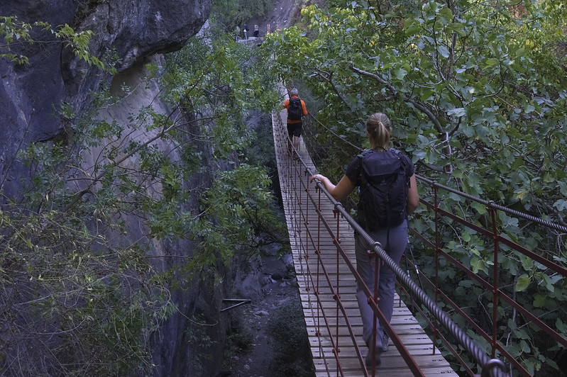
Hiking the Monachil Gorge (also known as the Los Cahorros de Monachil) is one of the most popular and scenic hikes near Granada, offering a thrilling adventure through a narrow canyon, along hanging bridges, waterfalls, and carved rock passages. It’s a great mix of natural beauty and light adrenaline.,There are several suspension bridges, some quite long and exciting, crossing the gorge above the river, offering spectacular views. Safe but thrilling—especially popular with children. Certain areas require walking through narrow passages carved by the river. Occasionally you’ll need to crouch, climb ladders or handles set into rock walls—adds to the adventurous feel of the hike. There are crystal-clear streams, small waterfalls and pools ideal for cooling down on hot days.
×
Majalijar ridge
Sierra de Huetor
Grade: Moderate
Distance: 9 km
Ascent: 527 m
Time: 5 hrs
Optimal months: Jan to Dec incl
Map🗺️ -
3D⛰️ -
Guide🔗 -
Photos 📷
ℹ️ Read more
This walk is often just on faint goat tracks. We ascend from near the Puerta de la Moro northwards through pine forests before breaking out onto open hillsides.,Faint tracks lead up to the ridge which leads to the reigning peak of Majalijar. The ridge is rocky but mainly easy walking on limestone escarpment. Great views guaranteed southwards to the Sierra Nevada.,From the summit we drop steeply down north before traversing round the eastern shoulder of the ridge and entering the forests once again. A final drop down to the car makes a very entertaining and interesting circular route.
×
Trevenque
Cumbres Verdes
Grade: Challenging
Distance: 11 km
Ascent: 694 m
Time: 6 hrs
Optimal months: Mid-Sep to Mid-Jun
Map🗺️ -
3D⛰️ -
Guide🔗 -
Photos 📷
ℹ️ Read more
This well known summit is one of the most spectacular and dramatic in the Sierra Nevada. The mountain is steep on all sides but there are numerous ways up to it's majestic summit of 2079m.,We ascend the peak from Collado Sevilla and the arid badlands in the valley of Las Arenales. Then it's a steep climb up to the summit by-passing incredible pinnacles and rock formations.,It is steep but on a simple path where the hands are not really required. The summit is on a steep sided pinnacle with views in all directions as the mountain is isolated. A return is made initially the same way and then by using an undulating ridge with views to the Cerro Huenes group.
×
River Walk Rio Santos, Albunelas
Lecrin Valley
Grade: Leisurely
Distance: 6 km
Ascent: 152 m
Time: 3 hrs
Optimal months: May to Nov incl
Map🗺️ -
3D⛰️ -
Guide🔗 -
Photos 📷
ℹ️ Read more
Cool, fun and unique! Enjoy spectacular half day walks both in and around the rivers in Granada Province of Andalucia.,The route starts and ends at the town of Albuñuelas where we park the cars. Then its down to the river valley where we start enter the water. The path winds it's way in and out of the river, avoiding difficult sections. There are a couple of boulders to scale but these are easy.,It feels like you are exploring undiscovered sections of the Amazon! Always above your head is a green canopy of foliage and plants and insects rarely seen outside these environments are spotted. The half way stage arrives at a huge waterfall which provides for an entertaining shower!,Some rails built into the rock provide a small challenge which is quikly overcome. Then it's back into the river and the narrowing gorge. At it's narrowest point the locals build a small dam, behind which lies a waist deep lake. This needs to be forded for us to continue our journey. We normally stop here for a swim and break.
×
Mulhacen from Alto Chorrillo
Mulhacen
Grade: Tough
Distance: 13 km
Ascent: 762 m
Time: 6 hrs
Optimal months: May to Nov incl
Map🗺️ -
3D⛰️ -
Guide🔗 -
Photos 📷
ℹ️ Read more
A 6 hour walk taking in the west ridge of the mountain and either descending the south ridge or (if time allows) we can visit the lakes at Siete Lagunas.,A superb day trip which gains not only the highest peak in mainland Spain (3482m) but also the most beautiful lakeside location in the range at Siete Lagunas. Spectacular views of the N faces!
×
Pico Lopera
Sierra de Almijara
Grade: Moderate
Distance: 9 km
Ascent: 269 m
Time: 5 hrs
Optimal months: Mid-Sep to Mid-Jun
Map🗺️ -
3D⛰️ -
Guide🔗 -
Photos 📷
ℹ️ Read more
From the trailhead, the path ascends steadily through a landscape characterized by typical Mediterranean vegetation. The trail is well-marked but can be rocky in sections, so sturdy footwear is recommended.,Upon reaching the summit at 1,481 meters, hikers are rewarded with expansive views of the surrounding sierras and valleys. The vantage point provides a unique perspective of the rugged terrain and, on clear days, glimpses of the Mediterranean Sea.,The descent follows a looped path that brings hikers back to the starting point, offering different scenery and perspectives along the way.
×
Ruta Gollinzo, Moclin
Granada
Grade: Moderate
Distance: 8 km
Ascent: 539 m
Time: 5 hrs
Optimal months: Mid-Sep to Mid-Jun
Map🗺️ -
3D⛰️ -
Guide🔗 -
Photos 📷
ℹ️ Read more
The Ruta del Gollizno, located in the municipality of Moclín in the province of Granada, Spain, is a captivating circular hiking trail that combines natural beauty with historical significance. This route offers hikers the opportunity to traverse scenic landscapes, cross suspension bridges, explore river gorges, and encounter ancient cultural landmarks.,The trail passes through breathtaking terrain, including steep canyons, lush river valleys, dramatic cliffs, waterfalls, caves, and panoramic views of the surrounding olive groves and mountains. Stunning viewpoints offer beautiful vistas of the medieval fortress of Moclín, the village itself, and the entire Granada countryside.,The Ruta del Gollizno features exciting hanging bridges (puentes colgantes) crossing the Gollizno gorge. These bridges are a major attraction, adding adventure and excitement to the hike. Metal walkways attached to the canyon walls lead you through narrow and beautiful sections of the gorge, making the route feel adventurous and unique.,Moclín is a historically significant village dominated by the impressive Moclín Castle (Castillo de Moclín), which was a crucial Moorish fortress during the Reconquista period. The route passes near ancient cave paintings at the Cuevas de Malalmuerzo, dating back to prehistoric times, offering hikers an opportunity to connect with the area's deep historical roots. The trail runs along the Río Velillos, a small river that creates picturesque waterfalls and crystal-clear pools, especially beautiful after rain or in spring. Excellent spot for photography, relaxation, or a refreshing break on hotter days.
×
Traverse of Chullo, Puerto de la Ragua
Sierra Nevada Summits
Grade: Challenging
Distance: 15 km
Ascent: 600 m
Time: 6 hrs
Optimal months: May to Nov incl
Map🗺️ -
3D⛰️ -
Guide🔗 -
Photos 📷
ℹ️ Read more
Climbing Pico Chullo (2,611 m), the highest peak in the province of Almería, from Puerto de la Ragua is a rewarding yet relatively accessible high-mountain hike in the eastern Sierra Nevada. It’s one of the easiest 2,600+ meter summits in Spain and an ideal day hike.
×
Niguelas Falla and Sendero Pavilla
Lecrin Valley
Grade: Leisurely
Distance: 5 km
Ascent: 150 m
Time: 2 hrs
Optimal months: Mid-Sep to Mid-Jun
Map🗺️ -
3D⛰️ -
Guide🔗 -
Photos 📷
ℹ️ Read more
The Falla de Nigüelas is a significant geological fault located near Nigüelas. Due to its geological importance and relatively recent formation, the Falla de Nigüelas was declared a Natural Monument.,The Sendero de la Pavilla is a scenic hiking trail that begins in Nigüelas and offers a relatively easy and family-friendly route. The trail largely follows an irrigation channel, known locally as an acequia, and provides hikers with stunning views of the Río Torrente gorge and the broader Valle de Lecrín. One of the trail's highlights is a section where the acequia passes between two closely set vertical rock walls, navigable via a metal grate installed over the channel. Along the route, hikers will encounter features such as a water distribution point that channels water towards the acequia de La Pavilla and the Valle de Lecrín, as well as a charming fountain fed by the acequia's waters.
×
Fuentes de Conchar
Lecrin Valley
Grade: Moderate
Distance: 12 km
Ascent: 336 m
Time: 5 hrs
Optimal months: Mid-Sep to Mid-Jun
Map🗺️ -
3D⛰️ -
Guide🔗 -
Photos 📷
ℹ️ Read more
The trail traverses a mix of terrains, including lush valleys, vineyards, olive groves, and almond orchards. Hikers will also encounter cacti and scrubland, reflecting the region's rich biodiversity. Spectacular waterfalls too!,A notable highlight of the hike is the ascent to the Atalaya de Cónchar, an ancient watchtower offering panoramic views of the Lecrín Valley and the Sierra Nevada mountains.,Along the route, hikers can visit the Baños de Urquízar, natural thermal springs with an average temperature of 24 degrees Celsius, providing a refreshing spot to relax.
×
Peña de la Cruz
Sierra de Huetor
Grade: Challenging
Distance: 8 km
Ascent: 611 m
Time: 5 hrs
Optimal months: Jan to Dec incl
Map🗺️ -
3D⛰️ -
Guide🔗 -
Photos 📷
ℹ️ Read more
The Peñon de la Cruz is one of the finest viewpoints in these hills, especially to the Sierra Nevada in the south. It's not an easy climb from the village of Prado Negro either, especially the last half a kilometer to the summit. It's one of the unknown gems of this range and to be thoroughly recommended.
×
Cerro Alfaro
Tabernas
Grade: Challenging
Distance: 9 km
Ascent: 531 m
Time: 6 hrs
Optimal months: Mid-Sep to Mid-Jun
Map🗺️ -
3D⛰️ -
Guide🔗 -
Photos 📷
ℹ️ Read more
Embarking on a hike to Cerro Alfaro, a prominent peak in the Sierra Alhamilla near Almería, Spain, offers adventurers a moderately challenging ascent with rewarding panoramic views of the Tabernas Desert and surrounding landscapes.
×
Tabernas Desert Loop
Tabernas
Grade: Moderate
Distance: 12 km
Ascent: 150 m
Time: 5 hrs
Optimal months: Mid-Sep to Mid-Jun
Map🗺️ -
3D⛰️ -
Guide🔗 -
Photos 📷
ℹ️ Read more
Hiking in the Tabernas Desert is like stepping into a Wild West movie — and for good reason! Known as the only true desert in Europe, this surreal landscape of badlands, dry riverbeds (ramblas), canyons, and sculpted clay hills is not only geologically fascinating, but has served as the backdrop for dozens of iconic spaghetti westerns.
×
Circular Lentegi PR440
Sierra de Almijara
Grade: Challenging
Distance: 16 km
Ascent: 697 m
Time: 6 hrs
Optimal months: Mid-Sep to Mid-Jun
Map🗺️ -
3D⛰️ -
Guide🔗 -
Photos 📷
ℹ️ Read more
Embarking on the PR-A 440 Jaloche - Cortijo de Lizardo trail offers hikers a challenging yet rewarding experience in the picturesque landscapes surrounding Lentegí, Granada. This circular route is renowned for its diverse terrains, scenic vistas, and cultural landmarks.
×
Petrified Waterfall Rio Verde
Sierra de Almijara
Grade: Moderate
Distance: 9 km
Ascent: 414 m
Time: 5 hrs
Optimal months: Mid-Sep to Mid-Jun
Map🗺️ -
3D⛰️ -
Guide🔗 -
Photos 📷
ℹ️ Read more
Hiking to the Petrified Waterfall in the Río Verde area near Otívar, Granada, offers an enriching experience that combines natural beauty with a touch of geological intrigue. This trail is renowned for its scenic landscapes, including the unique petrified waterfall where mineral-rich waters have fossilized tree trunks over time.
×
Threading the Raspones
Sierra Nevada
Grade: Very Tough
Distance: 13 km
Ascent: 674 m
Time: 7 hrs
Optimal months: May to Nov incl
Map🗺️ -
3D⛰️ -
Guide🔗 -
Photos 📷
ℹ️ Read more
The Raspones de Río Seco are prominent peaks in Spain's Sierra Nevada mountain range, situated between the glacial basins of Río Seco and Veleta. This ridge features two main summits: the northern peak at 3,141 meters and the slightly lower southern peak at 3,137 meters, separated by a small breach which we pass through.
×
Tozal de Cartujo
Sierra Nevada Summits
Grade: Very Tough
Distance: 14 km
Ascent: 532 m
Time: 8 hrs
Optimal months: May to Nov incl
Map🗺️ -
3D⛰️ -
Guide🔗 -
Photos 📷
ℹ️ Read more
Embarking on a hike up the Tozal del Cartujo (3,152 meters) in Spain's Sierra Nevada offers a rewarding experience for seasoned hikers and mountaineers. This peak, located between the Lanjarón and Dílar valleys, provides panoramic views of the surrounding landscapes
×
Las Alegas via Barrancillos
Sierra Nevada Summits
Grade: Challenging
Distance: 10 km
Ascent: 656 m
Time: 7 hrs
Optimal months: May to Nov incl
Map🗺️ -
3D⛰️ -
Guide🔗 -
Photos 📷
ℹ️ Read more
From the starting point, head north through the Barrancillos area. This section involves ascending a shallow gully, primarily pathless, with some goat trails through pine forests. After approximately 45 minutes, you'll reach the upper tree line and continue to the broad ridge leading to the summit of Las Alegas (2,700 meters). ,From the summit, continue north for about 200 meters before descending westward to an old drover trail. Follow this trail south to reach the Refugio Cebollar (2,500 meters), a ruined refuge set in a picturesque alpine meadow with a natural spring. ,Ascend alongside the forest edge to regain the broad ridge from the approach. Return via another shallow valley south of the ascent route through wooded slopes back to the starting point.
×
Rio Bermejo
Alpujarras
Grade: Moderate
Distance: 9 km
Ascent: 529 m
Time: 4 hrs
Optimal months: Mid-Sep to Mid-Jun
Map🗺️ -
3D⛰️ -
Guide🔗 -
Photos 📷
ℹ️ Read more
The Río Bermejo circular walk, starting from Pitres in the Alpujarras region of Spain, is a scenic trail that offers hikers a chance to experience the natural beauty and cultural heritage of the area. ,The trail takes you through varied terrains, including lush river valleys, traditional irrigation channels (acequias), and picturesque white-washed villages that are characteristic of the Alpujarras. ,The route offers stunning views of the surrounding mountains and valleys, with the Río Bermejo itself being a notable feature, especially during seasons when the water flow is robust.
×
Peñon de la Mata
Sierra de Huetor
Grade: Moderate
Distance: 7 km
Ascent: 400 m
Time: 5 hrs
Optimal months: Mid-Sep to Mid-Jun
Map🗺️ -
3D⛰️ -
Guide🔗 -
Photos 📷
ℹ️ Read more
The Peak of the Dead rises behind the town of Cogollos Vega and makes a very pleasant circular day walk. The mountain from a distance looks impregnable, but a gentle path ascends to a col where a wonderful surprise awaits, the whole of the Sierra Nevada range spread out before you to the south!,The ascent to the peak is a bit loose and rocky, but nowhere involving the use of hands. The view from the summit is superlative. We return to a small col and take a traverse path below dramatic cliffs which encircle the mountain.,The valley north of the Penon de la Mata is agricultural but has a very wild and unkept feel. Few others will be met. A little gem and yet, so close to the centre of Granada.
×
Boca de la Pesca
Cumbres Verdes
Grade: Leisurely
Distance: 7 km
Ascent: 308 m
Time: 4 hrs
Optimal months: Mid-Sep to Mid-Jun
Map🗺️ -
3D⛰️ -
Guide🔗 -
Photos 📷
ℹ️ Read more
Boca de la Pesca, ‘mouth of the fish’ is so named due to its supposed resemblance to a fish head as seen from the north east. The path to its isolated summit starts from Collado Sevilla and initially follows the dirt track south west past a few houses and holiday homes and then west over the small peak of Cerro de las Pipas.,Here there is a choice of paths that all lead to and eventually converge on the northern side of the peak and the foot of the ‘fish head’. A couple of long zig-zags and the westerly, slightly lower, summit is reached.,Here there is a small domed building which is possibly used in summer months as a fire lookout point. The southern slopes drop steeply down into the Dílar gorge. The slightly higher eastern peak is a 5 minute walk away. The best descent is initially the same way and thereafter by a few of the variations along the way.
×
Refugio Cebollar
Sierra Nevada
Grade: Challenging
Distance: 15 km
Ascent: 926 m
Time: 7 hrs
Optimal months: May to Nov incl
Map🗺️ -
3D⛰️ -
Guide🔗 -
Photos 📷
ℹ️ Read more
Hiking to Refugio Cebollar from Puente Palo is a beautiful, moderately challenging route in the Alpujarras sector of the Sierra Nevada, offering forested trails, alpine meadows, and big views toward the Las Alegas ridge and the high peaks beyond.
×
Acequias del Poqueira
Alpujarras
Grade: Moderate
Distance: 12 km
Ascent: 220 m
Time: 4 hrs
Optimal months: Jan to Dec incl
Map🗺️ -
3D⛰️ -
Guide🔗 -
Photos 📷
ℹ️ Read more
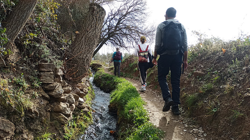
Walking the acequias of the Poqueira Gorge is one of the most beautiful and peaceful hiking experiences in the Alpujarras region of the Sierra Nevada, combining ancient Moorish water engineering, dramatic scenery, and traditional whitewashed villages.,These acequias (irrigation channels) follow gentle gradients along the gorge and hillsides, offering shady, lush paths with panoramic views. Many of them date back to Islamic times and are still in use today, watering the terraced fields of Capileira, Bubión, and Pampaneira.
×
Ruta Pescados, Lanjaron
Alpujarras
Grade: Moderate
Distance: 11 km
Ascent: 387 m
Time: 4 hrs
Optimal months: Mid-Sep to Mid-Jun
Map🗺️ -
Guide🔗 -
Photos 📷
ℹ️ Read more
This is a relatively new route that celebrates the route that fishermen from the coast used to take to deliver their fish to the mountain villages.,We leave our hotel and follow a well marked path to a viewpoint over the town and surrounding mountains. Then we descend towards the Rules Dam following green streams and valleys. Climbing up to another viewpoint we meet a swing chair installed by the town hall.,A short stretch of road walking follows before we drop down steeply into the lush Rio Lanjaron valley, below towering cliffs. The steep climb back up to the castle in town isn't as bad as it looks as the trail is well graded.
×
Ruta Pescados, Lanjaron
Lanjaron
Grade: Moderate
Distance: 11 km
Ascent: 387 m
Time: 4 hrs
Optimal months: Mid-Sep to Mid-Jun
Map🗺️ -
Guide🔗 -
Photos 📷
ℹ️ Read more
This is a relatively new route that celebrates the route that fishermen from the coast used to take to deliver their fish to the mountain villages.,We leave our hotel and follow a well marked path to a viewpoint over the town and surrounding mountains. Then we descend towards the Rules Dam following green streams and valleys. Climbing up to another viewpoint we meet a swing chair installed by the town hall.,A short stretch of road walking follows before we drop down steeply into the lush Rio Lanjaron valley, below towering cliffs. The steep climb back up to the castle in town isn't as bad as it looks as the trail is well graded.
×
Cerecillo - Mezquerina
Lanjaron
Grade: Challenging
Distance: 13 km
Ascent: 981 m
Time: 5 hrs
Optimal months: Mid-Sep to Mid-Jun
Map🗺️ -
3D⛰️ -
Guide🔗 -
Photos 📷
ℹ️ Read more
The Cerecillo-Mezquerina Trail is a challenging circular hiking route near Lanjarón, Granada, offering an immersive experience through the natural landscapes of the Alpujarras.,The trail prominently features traditional irrigation channels, known as acequias, integral to the region's agricultural practices. Hikers will follow these waterways, providing both scenic beauty and insight into local water management.!,Throughout the hike, there are expansive views over the Río Lanjarón Valley and, on clear days, vistas extending towards the Mediterranean coast.
×
Huerta de las Monjas
Lanjaron
Grade: Leisurely
Distance: 5 km
Ascent: 263 m
Time: 2 hrs
Optimal months: Mid-Sep to Mid-Jun
Map🗺️ -
3D⛰️ -
Guide🔗 -
Photos 📷
ℹ️ Read more
Acequia Waterways: The trail prominently features traditional irrigation channels, known as acequias, integral to the region's agricultural practices. Hikers will follow these waterways, providing both scenic beauty and insight into local water management.,Scenic Views: Throughout the hike, there are expansive views over the Río Lanjarón Valley and, on clear days, vistas extending towards the Mediterranean coast.
×
Prado Llano and Refugio Poqueira
Sierra Nevada
Grade: Moderate
Distance: 17 km
Ascent: 758 m
Time: 6 hrs
Optimal months: May to Nov incl
Map🗺️ -
3D⛰️ -
Guide🔗 -
Photos 📷
ℹ️ Read more
Hiking from Hoya del Portillo to Prado Llano and Refugio Poqueira is a fantastic route that explores the high slopes of the Sierra Nevada, blending alpine forests, historic trails, glacial valleys, and stunning views toward Mulhacén and the Poqueira Gorge.
×
La Maroma from the north
Sierra de Almijara
Grade: Tough
Distance: 16 km
Ascent: 965 m
Time: 7 hrs
Optimal months: Jan to Dec incl
Map🗺️ -
3D⛰️ -
Guide🔗 -
Photos 📷
ℹ️ Read more
Hiking La Maroma (2,066 m) — the highest peak in the Sierra de Tejeda — from the north is a spectacular and lesser-traveled approach to this iconic summit. Unlike the more popular southern route from Canillas de Aceituno, the northern route offers alpine forest, solitude, and impressive views over the Arenas del Rey and Alhama de Granada areas.
×
Northern Flanks of the Sierra Nevada
Sierra Nevada
Grade: Tough
Distance: 15 km
Ascent: 857 m
Time: 9 hrs
Optimal months: May to Nov incl
Map🗺️ -
3D⛰️ -
Guide🔗 -
Photos 📷
ℹ️ Read more
Embarking on a trek from Posiciones del Veleta through Corral del Veleta, Veta Grande, Laguna de la Gabata, and Pico de los Bolos, returning via the old road, offers a comprehensive exploration of the Sierra Nevada's diverse terrains.,Posiciones del Veleta: Offers panoramic views and serves as a historical site from the Spanish Civil War. Corral del Veleta: A glacial cirque beneath the Veleta peak, showcasing remnants of ancient glaciers. Veta Grande: A prominent ridge leading towards Cerro de los Machos, providing challenging terrains for seasoned hikers. Laguna de la Gabata: A high-altitude glacial lake offering serene landscapes and opportunities for rest. Pico de los Bolos: A notable summit providing expansive views of the surrounding ranges.
×
Vasar de Mulhacen
Sierra Nevada
Grade: Very Tough
Distance: 15 km
Ascent: 925 m
Time: 8 hrs
Optimal months: May to Nov incl
Map🗺️ -
3D⛰️ -
Guide🔗 -
Photos 📷
ℹ️ Read more
Hiking the Vasar de Mulhacén is one of the most spectacular and exposed high-mountain routes in the Sierra Nevada, traversing the dramatic north face of Mulhacén (3,479 m) — the highest peak in mainland Spain. This route is not a typical hike: it’s an aerial traverse along a narrow ledge halfway up a steep glacial cirque, offering breathtaking scenery and a dose of adrenaline.
×
Lavaderos de la Reina and Northern Peaks
Sierra Nevada Summits
Grade: Very Tough
Distance: 22 km
Ascent: 1115 m
Time: 10 hrs
Optimal months: May to Nov incl
Map🗺️ -
3D⛰️ -
Guide🔗 -
Photos 📷
ℹ️ Read more
Exploring the Lavaderos de la Reina alongside the northern peaks of the Sierra Nevada, such as Picón de Jerez and Puntal de los Cuartos, offers a captivating hiking experience through some of Spain's most stunning high-altitude landscapes.
×
Cerro de Caballo Tres Mojones ridge
Sierra Nevada Summits
Grade: Challenging
Distance: 12 km
Ascent: 961 m
Time: 7 hrs
Optimal months: May to Nov incl
Map🗺️ -
3D⛰️ -
Guide🔗 -
Photos 📷
ℹ️ Read more
Ascending Cerro del Caballo (3,011 meters) from Rinconada de Nigüelas offers a rewarding hike to one of the Sierra Nevada's prominent peaks. This route provides expansive views and a satisfying summit experience.,The hike begins at the Mirador de la Rinconada, accessible via a dirt track from Nigüelas. From the Mirador, a path leads through pine groves, ascending steadily along the Loma de los Tres Mojones ridge. The trail continues along the ridge, offering panoramic views of the surrounding valleys and peaks. Approach the summit via a well-trodden path, culminating at the peak of Cerro del Caballo,Laguna del Caballo: A glacial lake near the summit, often frozen in winter months. Refugio del Caballo: A basic shelter located near the lake, useful in emergencies.
×
Cerro Lucero
Sierra de Almijara
Grade: Challenging
Distance: 11 km
Ascent: 858 m
Time: 6 hrs
Optimal months: Jan to Dec incl
Map🗺️ -
3D⛰️ -
Guide🔗 -
Photos 📷
ℹ️ Read more
Climbing Cerro Lucero (also known as Raspón de los Moriscos, 1,779 m) from the north side offers a wild and beautiful hike through the remote heart of the Sierra Almijara, with panoramic views stretching from the Mediterranean coast to the Sierra Nevada. This northern route is more adventurous and less frequented than the popular southern approach from La Resinera or Competa.
×
Barranco del Cerezo and Hoya del Portillo
Sierra Nevada
Grade: Challenging
Distance: 14 km
Ascent: 564 m
Time: 6 hrs
Optimal months: Jan to Dec incl
Map🗺️ -
3D⛰️ -
Guide🔗 -
Photos 📷
ℹ️ Read more
The Barranco del Cerezo is a picturesque ravine located in the Sierra Nevada region, known for its natural beauty, diverse vegetation, and serene environment. Hiking in this area typically involves traversing narrow paths alongside streams, with opportunities to observe local flora and fauna,Hoya del Portillo serves as a common starting point for several high-altitude hikes in the Sierra Nevada, including routes leading to Mulhacén, the highest peak in mainland Spain. Located near the village of Capileira, it's accessible by vehicle up to a certain point, after which trails of varying difficulty levels are available.
×
Las Arenales and Dilar Valley
Cumbres Verdes
Grade: Challenging
Distance: 12 km
Ascent: 521 m
Time: 6 hrs
Optimal months: Mid-Sep to Mid-Jun
Map🗺️ -
3D⛰️ -
Guide🔗 -
Photos 📷
ℹ️ Read more
A contasting and constantly interesting hike through very varied scenery.,From Collado Sevilla we take a rough trail through arid badlands into the Barranco de Buho and hence to Las Arenales dry river valley. We turn right through a small pass and the walk contrasts instantly. Gone are the dry badlands and we enter the green and lush Dilar valley.,Dropping through pine forests we encounter the delightful Cortijo Rosales with it's super views. A great place for lunch! Then further down through the forest before linking with a path contouring round a dramatic gorge high above the Dilar Valley. This leads back to the start point.
×
Ascent of Alcazaba via Cañada de Siete Lagunas
Sierra Nevada Summits
Grade: Very Tough
Distance: 22 km
Ascent: 1770 m
Time: 12 hrs
Optimal months: May to Nov incl
Map🗺️ -
3D⛰️ -
Guide🔗 -
Photos 📷
ℹ️ Read more
Alcazaba (3371m) is without doubt one of the finest mountains in the Sierra Nevada. Its very name ,’the Fortress’, invokes a feeling of invincibility and impregnability. It is surrounded by cliffs and yet to the south and east there are chinks in its armor that give pleasant ways to its lofty summit. There are three walking routes to the summit from Siete Lagunas. The route via El Colaero being the most spectacular
×
Ascent of Mulhacén via Cañada de Siete Lagunas
Mulhacen
Grade: Very Tough
Distance: 21 km
Ascent: 1870 m
Time: 13 hrs
Optimal months: May to Nov incl
Map🗺️ -
3D⛰️ -
Guide🔗 -
Photos 📷
ℹ️ Read more
Climbing Mulhacén (3,479 m), the highest peak in mainland Spain, via the Cañada de las Siete Lagunas from Trevélez is one of the most iconic and beautiful ascents in the Sierra Nevada. This route is steep, scenic, and steeped in local history — passing through alpine meadows, waterfalls, and the famous Siete Lagunas glacial cirque.
×
A round of the Río Juntillas and Treveléz valleys
Sierra Nevada Summits
Grade: Very Tough
Distance: 28 km
Ascent: 2176 m
Time: 16 hrs
Optimal months: May to Nov incl
Map🗺️ -
3D⛰️ -
Guide🔗 -
Photos 📷
ℹ️ Read more
A multi day trekking route for lovers of solitude and wild scenery covering some unfrequented sections of the Sierra Nevada. The circular route goes up the Río Juntillas to the main ridge and descends the Río Puerto de Jérez. Covers 3000m peaks, remote situations together with abundant water and some delectable camping and bivouac spots. Few others will be seen above the Refugio Horcajo
×
Barranco de Poqueira circular
Sierra Nevada
Grade: Challenging
Distance: 20 km
Ascent: 930 m
Time: 8 hrs
Optimal months: May to Nov incl
Map🗺️ -
3D⛰️ -
Guide🔗 -
Photos 📷
ℹ️ Read more
A must do circular offering a contrasting day walk from Capileira that provides a good introduction to the delights of the Sierra Nevada. Initially follows irrigation channels (acequias) on the eastern side of the gorge, returning high above on its western side before joining the river towards the end.
×
Ascent of Mulhacén from Hoya del Portillo
Mulhacen
Grade: Tough
Distance: 23 km
Ascent: 1331 m
Time: 9 hrs
Optimal months: May to Nov incl
Map🗺️ -
3D⛰️ -
Guide🔗 -
Photos 📷
ℹ️ Read more
From the Alpujarras in the south the ascent of Mulhacén, highest peak in mainland Spain can be done in a long day in the summer. This route avoids using the National Park bus and traverses the mountain without ever covering the same ground twice
×
Ascent of Mulhacén from Refugio Poqueira
Mulhacen
Grade: Challenging
Distance: 10 km
Ascent: 986 m
Time: 6 hrs
Optimal months: May to Nov incl
Map🗺️ -
3D⛰️ -
Guide🔗 -
Photos 📷
ℹ️ Read more
The classic traverse of the highest mountain in mainland Spain from the Refugio Poqueira ascending the steep west flank and descending via the long south ridge
×
A round of the Caldera peaks from Refugio Poqueira
Sierra Nevada Summits
Grade: Challenging
Distance: 10 km
Ascent: 680 m
Time: 6 hrs
Optimal months: May to Nov incl
Map🗺️ -
3D⛰️ -
Guide🔗 -
Photos 📷
ℹ️ Read more
Two worthwhile objectives often neglected or bypassed in the rush to climb Mulhacén. Both peaks give impressive vistas over the northern precipices of the Sierra Nevada. There is some simple scrambling (mostly avoidable) up the east ridge of the Puntal de la Caldera
×
Around Mulhacén via the Vasar and Siete Lagunas
Sierra Nevada
Grade: Challenging
Distance: 12 km
Ascent: 900 m
Time: 7 hrs
Optimal months: May to Nov incl
Map🗺️ -
3D⛰️ -
Guide🔗 -
Photos 📷
ℹ️ Read more
This circular walk around Mulhacén takes an improbable looking horizontal shelf (Vasar de Mulhacén) across the seemingly vertical north face of Mulhacén to reach the peak of Puntal de Siete Lagunas. An adrenaline-filled but very straightforward walk to a superb summit with only one short section where the hands need to leave the pockets. A head for heights is advisable though.,It continues round into Siete Lagunas and returns to the refuge via the eastern traverse of Mulhacén. A relatively unknown route that visits some remarkable situartions on rarely visited paths
×
The Púlpitos from Refugio Poqueira
Sierra Nevada Summits
Grade: Moderate
Distance: 10 km
Ascent: 667 m
Time: 5 hrs
Optimal months: May to Nov incl
Map🗺️ -
3D⛰️ -
Guide🔗 -
Photos 📷
ℹ️ Read more
Useful as a half day or acclimatisation trip from the refuge. The Púlpitos are quiet peaks, rarely ascended as they don’t reach that magical 3000m height, but they provide fine objectives for an easier day nevertheless
×
Pico del Tajo de los Machos and Cerrillo Redondo
Sierra Nevada Summits
Grade: Tough
Distance: 18 km
Ascent: 1413 m
Time: 9 hrs
Optimal months: May to Nov incl
Map🗺️ -
3D⛰️ -
Guide🔗 -
Photos 📷
ℹ️ Read more
For those who like their mountains tough, rugged, wild and unfrequented this is a ‘must do’ route. A circular route full of interest, challenges and glorious scenery culminating in the ascent of a rarely visited 3000m peak
×
Cerro del Caballo from the south
Sierra Nevada Summits
Grade: Challenging
Distance: 18 km
Ascent: 1221 m
Time: 7 hrs
Optimal months: May to Nov incl
Map🗺️ -
3D⛰️ -
Guide🔗 -
Photos 📷
ℹ️ Read more
A long ascent of Europe’s most southerly 3000m peak ascending high above the Lanjarón valley and descending with extensive views towards the western mountains and plains
×
The Silleta de Padul from Dilar
Cumbres Verdes
Grade: Moderate
Distance: 13 km
Ascent: 570 m
Time: 6 hrs
Optimal months: Jan to Dec incl
Map🗺️ -
3D⛰️ -
Guide🔗 -
Photos 📷
ℹ️ Read more
The Silleta de Padul is at the very western end of the Sierra Nevada. It commands a spectacular 360 degree view and is well worth the effort of the steep ascent through pine forests to its summit. After traversing low ridges to the east a return is made north west through forests back to Dílar.
×
Integral de los Alayos from Dilar
Cumbres Verdes
Grade: Tough
Distance: 18 km
Ascent: 1240 m
Time: 8 hrs
Optimal months: Jan to Dec incl
Map🗺️ -
3D⛰️ -
Guide🔗 -
Photos 📷
ℹ️ Read more
This remote ridge can be accessed from the Dilar valley or indeed Collado Sevilla. Well worth a day trip,Both start points give exhilarating access to this long, arid ridge which can be followed in its entirety by those with a head for heights. But, following the ridge crest can get tedious due to the amount of vegetation and rough ground. A better alternative is the good path just below the ridge crest.,The ridge has many summit but by far the best is the Corazon de la Sandia (Heart of the Watermelon). This peak is 1877m high and the final rise to the summit is an exposed scramble. This walk alternates between rich, green forests and dry arid badlands and thus gives a really interesting day walk!
×
Pico del Tesoro from Casa Forestal de la Cortijuela
Cumbres Verdes
Grade: Moderate
Distance: 8 km
Ascent: 350 m
Time: 4 hrs
Optimal months: May to Nov incl
Map🗺️ -
3D⛰️ -
Guide🔗 -
Photos 📷
ℹ️ Read more
The wooded hillsides and arid hills north of the road approaching the Casa Forestal de la Cortijuela provide an exceptionally beautiful yet moderate walk with superb views. The walk described forms a figure of eight loop, ascends the rough peaks of Pico del Tesoro and Cerro del Cocón and is perfect for a half day excursion from Granada
×
Veleta, Tajos de la Virgen and Lagunillas
Sierra Nevada Summits
Grade: Challenging
Distance: 17 km
Ascent: 850 m
Time: 7 hrs
Optimal months: May to Nov incl
Map🗺️ -
3D⛰️ -
Guide🔗 -
Photos 📷
ℹ️ Read more
Embarking on a hike that ascends Pico Veleta (3,398 meters), traverses the Tajos de la Virgen ridge, and returns via the Lagunillas area offers an exhilarating experience in the Sierra Nevada mountain range. This route combines challenging ascents, breathtaking ridge walks, and serene alpine lakes, providing a comprehensive adventure for seasoned hikers. This route offers a fulfilling challenge, combining one of the highest peaks in Spain with a stunning ridge traverse and tranquil alpine lakes, encapsulating the diverse beauty of the Sierra Nevada.
×
Cueva Secreta and Refugio Cucaracha
Sierra Nevada
Grade: Challenging
Distance: 19 km
Ascent: 1245 m
Time: 8 hrs
Optimal months: May to Nov incl
Map🗺️ -
3D⛰️ -
Guide🔗 -
Photos 📷
ℹ️ Read more
a circular hike that encompasses both Cueva Secreta and Refugio de la Cucaracha offers an immersive experience into the natural beauty and historical significance of the Sierra Nevada. This route combines lush river valleys, ancient mining paths, and serene mountain refuges, making it a favorite among seasoned hikers.,Walking along ancient mining routes and visiting traditional refuges provides a deep connection to the region's cultural and industrial past. The area is rich in biodiversity, with opportunities to observe native plant species and, occasionally, wildlife such as mountain goats and various bird species.
×
Mulhacén via Cueva Secreta and Río Genil
Mulhacen
Grade: Very Tough
Distance: 16 km
Ascent: 2789 m
Time: 15 hrs
Optimal months: May to Nov incl
Map🗺️ -
3D⛰️ -
Guide🔗 -
Photos 📷
ℹ️ Read more
Climbing Mulhacén (3,479 m) — the highest peak in mainland Spain — via Cueva Secreta is a challenging, beautiful, and lesser-known high-mountain route in the Sierra Nevada. This route ascends from the Vereda de la Estrella valley, passes the remote Cueva Secreta bivouac, and climbs steeply through wild, rugged terrain to the summit.,It’s a classic alpinist line, used by early climbers before modern tracks were created — tough, steep, remote, and stunning.
×
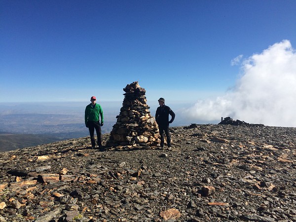
Picón de Jérez and round of the Alhorí valley
Sierra Nevada Summits
Grade: Tough
Distance: 16 km
Ascent: 1329 m
Time: 9 hrs
Optimal months: May to Nov incl
Map🗺️ -
3D⛰️ -
Guide🔗 -
Photos 📷
ℹ️ Read more
a circular hike that includes the ascent of Picón de Jérez (3,090 meters) and a traverse through the Alhorí Valley offers a rewarding experience in the Sierra Nevada region of Spain. This route combines high mountain scenery with lush valleys, providing diverse landscapes for hikers
×
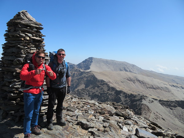
Los Tres Miles Integral 3000m peaks
Sierra Nevada Summits
Grade: Very Tough
Distance: 56 km
Ascent: 3569 m
Time: 25 hrs
Optimal months: May to Nov incl
Map🗺️ -
3D⛰️ -
Guide🔗 -
Photos 📷
ℹ️ Read more
We have a superb itinerary that we have been running since 2002. The only difference from the Classic Integral route from Jerez de Marsquedaso, is that we find an approach to the first 3000m peaks, Cerro Pelao and the Picon de Jerez is aesthetically nicer by starting from Trevelez in the south and following the valley of the Rio Trevelez. This puts us into position below just the main ridgeline at the end of the first day.,The main ridge is then followed over all the main 3000m+ summits of the range to the Cerro de Caballo, just before the long drop down to finish in the spa town of Lanjaron. In total you will climb 23 3000m+ peaks and be over 3000m for the majority of the trek.
×
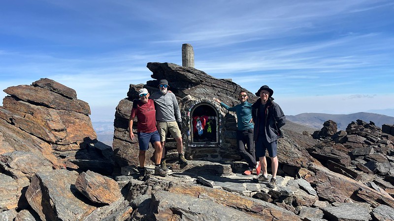
Los Tres Picos - Veleta, Mulhacén and Alcazaba
Sierra Nevada Summits
Grade: Tough
Distance: 37 km
Ascent: 2924 m
Time: 18 hrs
Optimal months: May to Nov incl
Map🗺️ -
3D⛰️ -
Guide🔗 -
Photos 📷
ℹ️ Read more
Tackling Los Tres Picos — Veleta (3,398 m), Mulhacén (3,479 m), and Alcazaba (3,371 m) — is one of the most epic and rewarding adventures you can do in the Sierra Nevada. These are the three highest peaks of the range (and mainland Spain), and connecting them in a multi-day trek is a serious but unforgettable high-mountain challenge.
×