Routes, Maps & Inspiration for Self Guided Walking & Hiking in Spain's Sierra Nevada


N.B This is an interactive map that opens up in new window
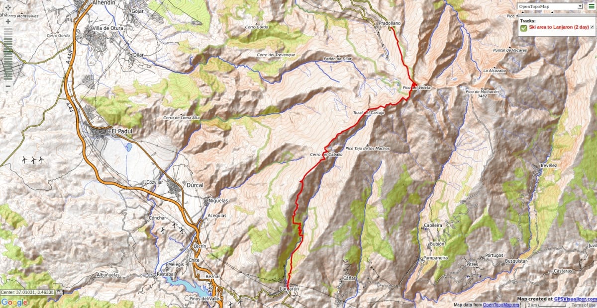
Ascend through the ski terrain, scrambling ridge of Tajos de la Virgen (or avoided by walking path on NW) to Refugio Elorrieta. Climb Pico del Cartujo. Wild camp near Tajos Altos. Ridge over Cerro de Caballo, down to Ventura ruins, Tello, Lanjaron
Major peaks covered: Pico del Cartujo 3152m, Tajos Altos 2985m, Cerro de Caballo 3005m
Great western ridge of the Sierra Nevada. Long and distant, expansive views. Tough descent down to the Alpujarran town of Lanjarón.
Seasonal notes: The mountain flank to the Elorietta may not be possible under snow as it is an avalanche blackspot.
Options: An easier return can be made by arranging for 4WD pickup at the trailhead beyond Peña Caballera or near the Casas Forestales at Tello.
Recommended map: Parque Nacional de Sierra Nevada 1:40000 www.penebetica.com
Want some help? Find a guide? CONTACT US
KNOWLEDGE BASE
Mountain database, refuges, altitude sickness, avalanche dangers, equipment lists, gear rental, FAQs etc
Contact us via our Contact Page Spanish Highs Tours Ltd Head Office:
41 Axholme Drive,
Epworth,
DN91EL,
North Lincolnshire,
UK.
Registered Office: 20-22 Wenlock Road, London, N1 7GU, England © 2019 sierranevada.guide
info@spanishhighs.co.uk
Company Number 09960909 Registered in England & Wales